Click here for other railways.
Railways In Portsmouth
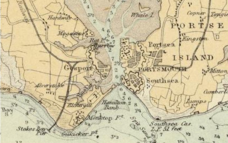
Portsmouth railway lines in 1872.
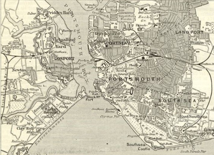
Portsmouth railway lines in 1890s.
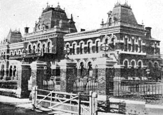
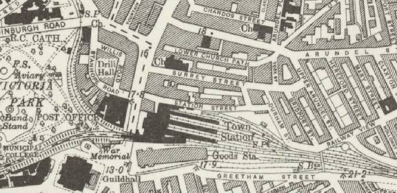
Portsmouth and Southsea Station
Opened as a terminus in 1847 called Portsmouth, renamed Portsmouth Town in 1876 and renamed again as Portsmouth and Southsea in 1925. From 1847 to 1866 the station was much smaller with the grander version being built in 1866. Initially, due to reluctance from the Admiralty to permit any extension, passengers for the Isle of Wight steamers travelled from the terminal station by tramway to Clarence Pier. In 1876 an extension (high-level) was built to the new terminus at Portsmouth Harbour.
In 1857 a branch line was built from the low-level platforms, across Commercial Road, to Portsmouth Dockyard. In 1876 a high-level extension was added to Portsmouth Harbour with a new track to Portsmouth Dockyard going off to the left.
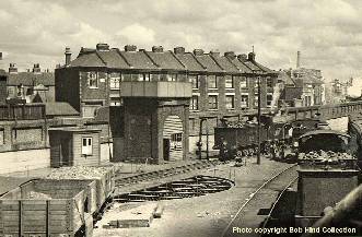
The photos show the station with the original crossing over Commercial Road, the new high-level track and the old turn-table.

1890's map.
Below is an earlier map of Portsmouth Town Station showing a smaller station, the engine shed and turntable. The tramway connection to Clarence Pier (bottom left) ran from the station complex right onto the pier. On the right is Blackfriars Road where there was a crossing (closed 1883) which, being so near the station and shunting areas, caused major traffic problems.
Earlier map.
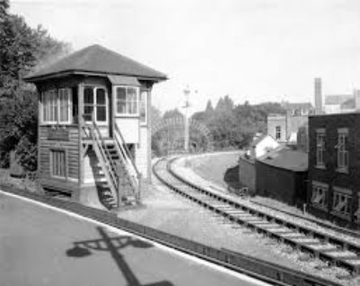
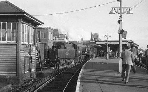
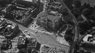
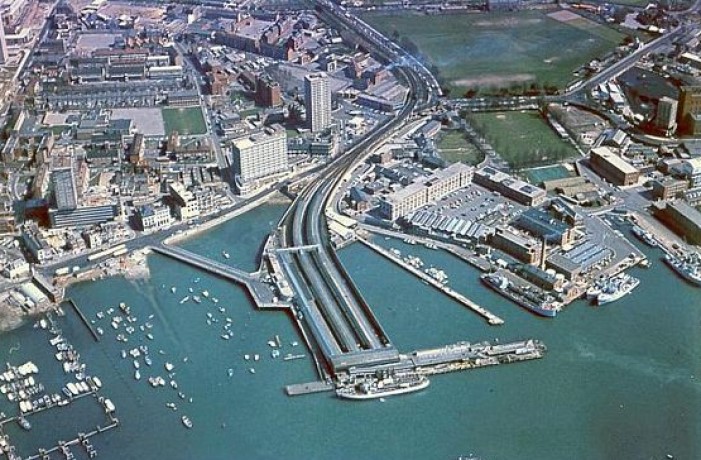
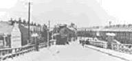
The 1960’s pictures show the signal box at the high-level with engine emerging and an aerial view of the sweep away to the right of the Dockyard branch.
Portsmouth Station Low Level early 1930s.
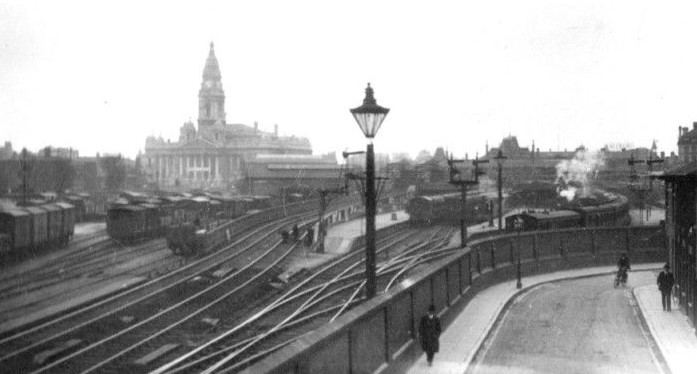
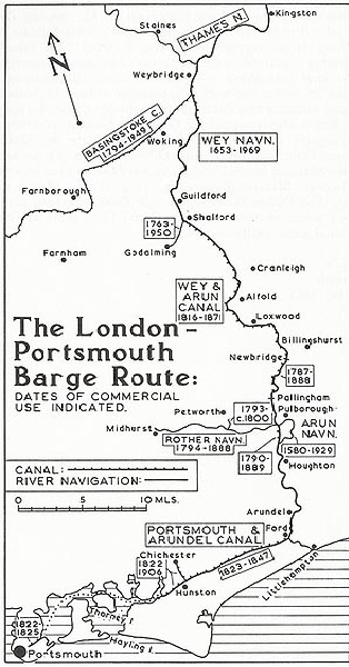
Diagram of the Portsmouth section of the canal and Route to London.

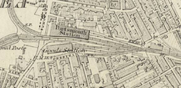
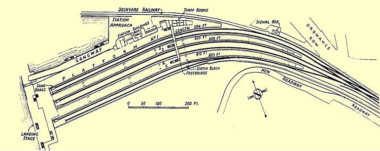
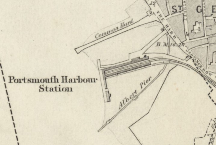
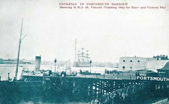
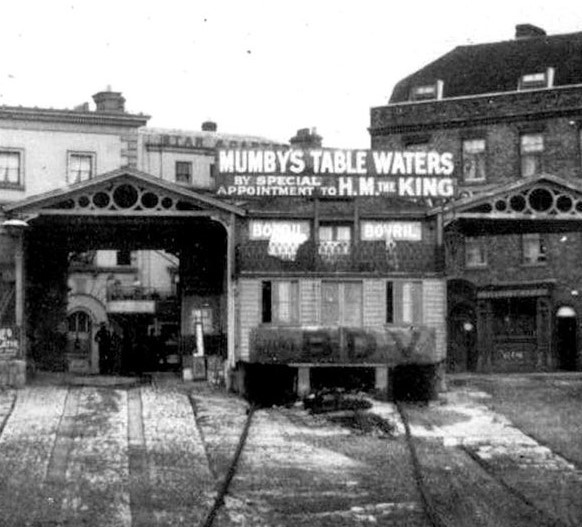
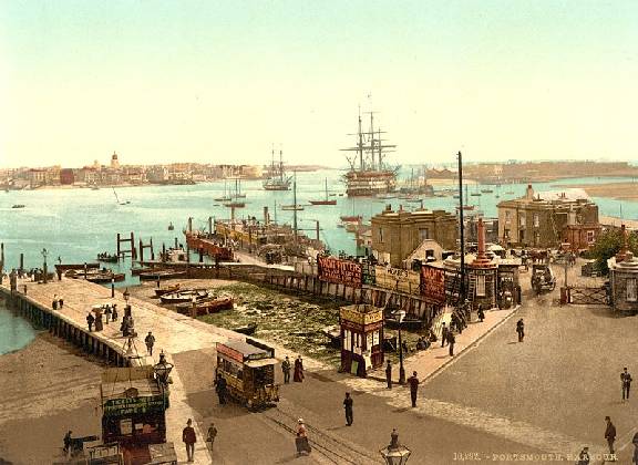
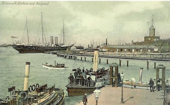
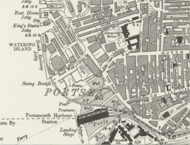
Portsmouth Harbour Station
Opened 1876 as an extension to the line at Portsmouth and Southsea. It was the terminus on the Portsmouth Waterside Extension Railway with a branch into Portsmouth Dockyard. Some sources state that the Dockyard branch was constructed to enable Queen Victoria's train access to the jetty within the dockyard when travelling to the Isle of Wight.
Ferries also ran from the pier to Ryde, Isle of Wight.
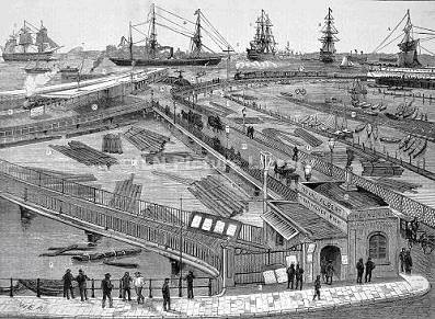
An impression of the station and Dockyard branch line in the 1800’s.
A 1950’s diagram of the track layout of the station with the post WW2 signal box and the Dockyard branch.
Portsmouth Harbour Station 1960s.
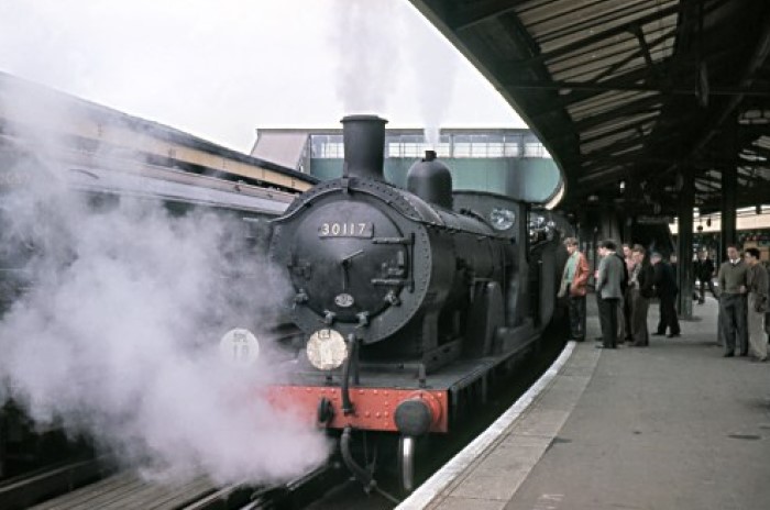
Portsmouth Harbour Station Probably 1970s.
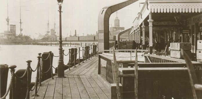
Portsmouth Harbour Station probably early 1900s.
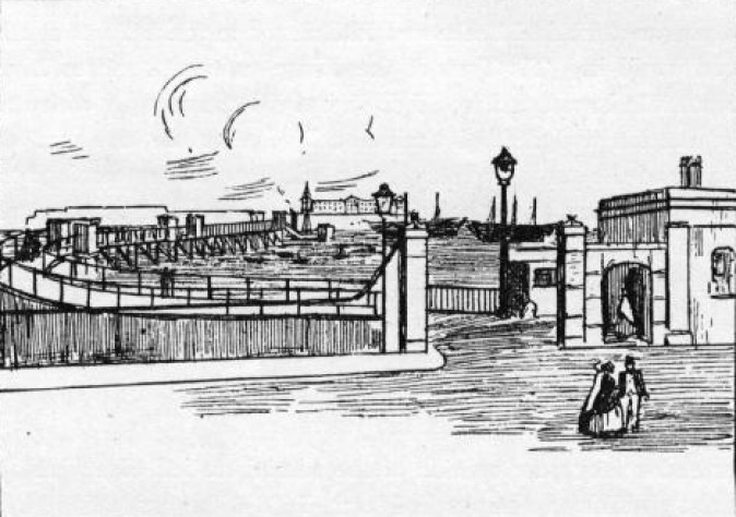
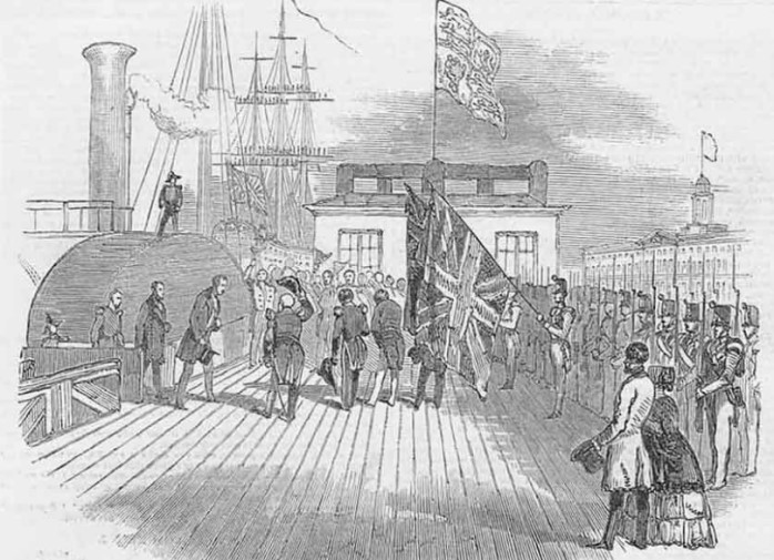
Albert Pier
Built in 1846 and used mainly as a landing place by the Gosport ferries and other vessels. The Harbour railway station and Gunwharf now occupy this site.
Albert Pier map late 1800s.
Albert Pier Entrance.
Prince Albert Boat Landing at Albert Pier 1847.
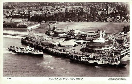
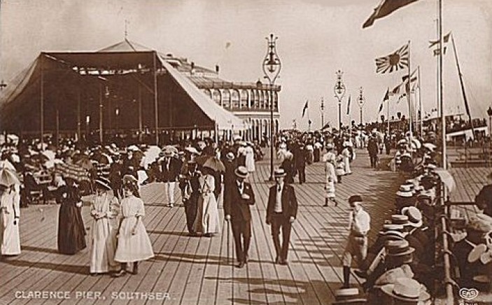
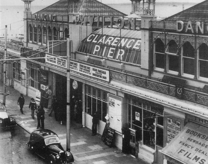
The original Clarence Pier was opened in 1861 by the Prince and Princess of Wales and boasted a regular ferry service to the Isle of Wight. A pavilion added in 1882. In 1886 a direct tram onto the pier from Portsmouth and Southsea Station was started. After 1873 the tram stopped just short of the pier. Extensions were built in 1905 and 1932. The Pier was bombed during WW2 and didn't re-open until 1961 when it became part of the fun fair. The Pier was unusual in being wider than it was long allowing it to accomodate two steamers.
The pier was originally constructed and opened in 1861 by the Prince and Princess of Wales[1] and boasted a regular ferry service to the Isle of Wight. It was damaged by air raids during World War II and was reopened in its current form on 1 June 1961 after being rebuilt by local architects A.E. Cogswell & Sons and R. Lewis Reynish
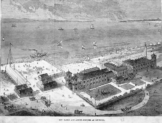
New Baths and Assembly Rooms 1871.
The Pier in the 1930s.
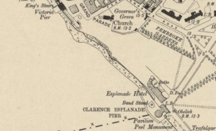
Clarence and Victoria Piers map early 1900s.
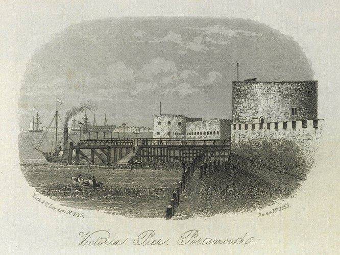
Victoria Pier
The pier was constructed in 1842 from the old beef landing stage alongside the Square Tower. This was the first such structure of its kind built in the town. It was primarily a landing stage for passenger steamers but became within a short space of time a popular promenade for local residents. It provided access directly into the High Street.
Engraving 1853.
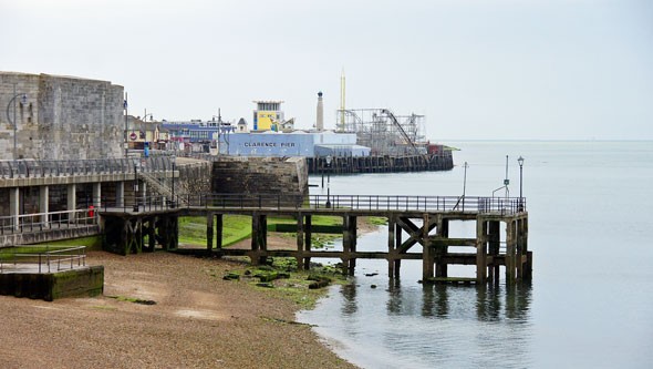
Pictures from 1930s and today.
Gosport Ferry, Floating Bridge and Portsmouth Point
Men were easily found and press-ganged into Nelson's navy from Portsmouth Point due to its hostelries and for being where prostitutes plied their trade. Historically, the Point lay outside the boundaries of Portsmouth, with access being controlled by various fortifications over the centuries. The advent of steam meant that more ships entered Portsmouth harbour proper and as a result fewer sailors visited the point. The gates that controlled access to the point were removed in the 1860s.
Watermen have carried passengers across Portsmouth Harbour for many centuries, and the trade had been regulated by the Court of Exchequer since 1603, which gave the rights to operate the service exclusively to inhabitants of Gosport. These rights tended to be held within families, passed from generation to generation. This restriction allowed overcharging, and an Act of Parliament was introduced in 1809 to regulate pricing, although it took until 1835 before a fixed fare table was set and adhered to. The watermen used double-ended rowing boats know as wherries, which continued in use for many years after the coming of steam. There were two main routes across the harbour from Gosport, one to the Point (Old Portsmouth) and one to the Hard (Portsea - near the naval base).
A horse ferry boat was introduced in 1834, prior to that time horses, carriages or carts faced a fourteen mile trip round the entire harbour.
Despite claims a regular ferry would throw eleven hundred of them out of work the watermen's monopoly was broken in 1840, when a steam-powered floating bridge, guided by chains, started operation between Gosport and Old Portsmouth. It transported carriages, carts, horses and even cattle as well as foot passengers. When the first railway in the area opened in 1841 to Gosport, the floating bridge received a lot of additional traffic continuing until 1959.
Originally a plan showed the proposed position of two Floating Bridges. The northern one was to finish at the old Gunwharf to serve Portsea, and the southern one would run to Point for the convenience of the population of Portsmouth. The Admiralty opposed the building of two Bridges, but it was left to the inhabitants of the Town to choose which route was the more acceptable. The meetings set up to discuss the matter were extremely heated and chaotic.
The watermen responded to the floating bridge by acquiring steam passenger ferries, which they operated from Gosport to the Hard. In 1875, the watermen formed the Gosport & Portsea Watermen's Steam Launch Company (known as the Old Company). The floating bridge company responded by operating their own passenger launches from Gosport to Old Portsmouth. When Portsmouth Harbour station opened in 1876 with an associated landing stage alongside the Old Company's passenger ferries had a big advantage over those of the floating bridge. The success of the passenger ferries prompted the formation of the Port of Portsmouth Steam Launch & Towing Company in 1883, known as the New Company, who placed three steam launches on the same route as the Old Company. This led the Old Company to raise money for a fourth and fifth boat. Competition between the Old and New Companies was fierce, until collaborative arrangements were instigated in 1888. As the new city centre grew, the importance of Old Portsmouth declined, and the fortunes of the Floating Bridge Company declined with it. In 1963, the New Company changed its name to the Portsmouth Harbour Ferry Company, and took over the Old Company.
The Gosport ferry continues to run today from a landing stage by Portsmouth Harbour station.
A number of the newer ferries began operating on the River Thames from 1981, mainly on the Westminster-Tower Pier-Greenwich route and some of the older ferries still exists as houseboats at Brentford.
Floating Bridge at The Point and Gosport in the early 1900s.
Steam Ferry at Harbour Station pontoon early 1900s.
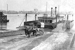
Old Ferries Today. Shoreham and Forton Lake Gosport.
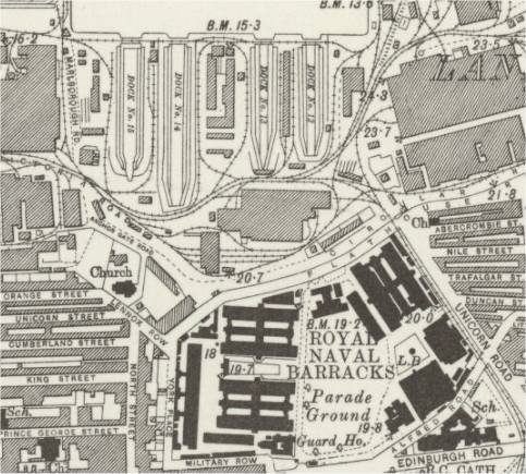
Portsmouth Dockyard
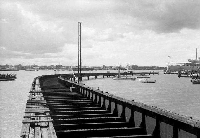
Portsmouth Dockyard was connected, via the Admiralty Line, to both Portsmouth Harbour Station and to Portsmouth and Southsea Station. The link from Portsmouth Harbour Station was initially intended for Queen Victoria to join her transport to the Isle of Wight - Osborne House. Prior to that, she travelled via Clarence Yard using another branch line from Gosport station. The line travelled across the harbour and included a swing bridge to let ships through. The swing bridge was lifted in 1946. The bridge had been damaged during the war. The last royal train to use the South Railway Jetty was in 1939.
There was also a line into Gunwharf running from Portsmouth Harbour Station.
The use of trains in the Dockyard declined in the 1970s and ceased entirely in 1978.
The first link from the main line into the Dockyard was opened in 1857 and that was a single track branch line that left Portsmouth and Southsea station at ground level, crossing Union Road (later Commercial Road), Victoria Park and Edinburgh Road before entering the Dockyard adjacent to Unicorn Gate.
Until 1876 the main line from London terminated at Portsmouth and Southsea station (low level), but in that year it was extended to Portsmouth Harbour. To achieve this the mainline was elevated in order to bridge Commercial Road and this offered the opportunity to replace the original link to the Dockyard using a branch from the high level station. This route required a steep descent from the station, along the rear of Victoria Park where it linked up with the original track.
1800’s impression of the Dockyard branch line from Portsmouth Harbour station.
Portsmouth Dockyard Viaduct being dismantled.
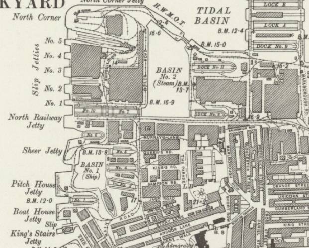
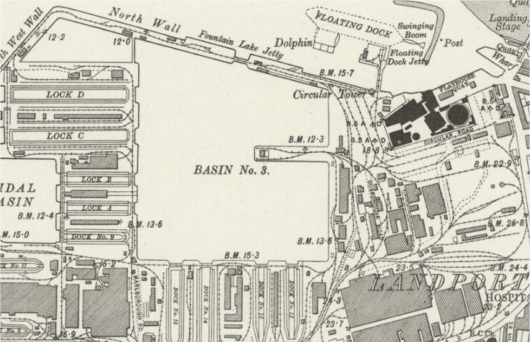
Railway networks in the Dockyard and Gunwharf.
The Unicorn Gate entrance from the branch line out of Portsmouth and Southsea station.
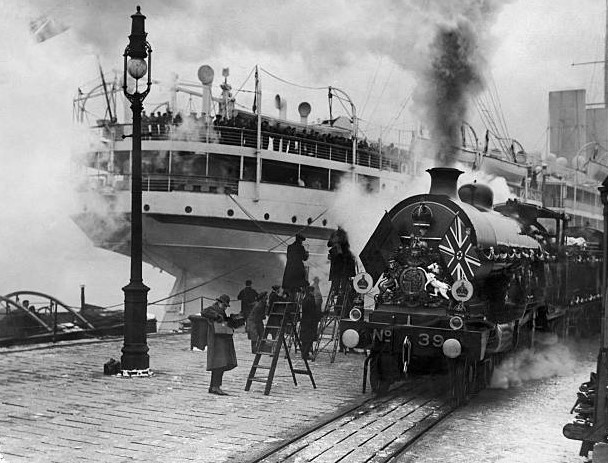
Royal Train in Dockyard 1900.
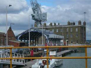
The 1885 Royal Railway Shelter at South Railway Jetty Building in the Dockyard after relocation.
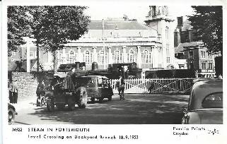
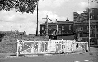
Edinburgh Road crossing in 1953 and the 1970’s.
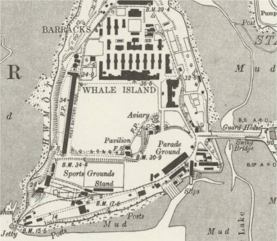
Whale Island
In 1867 a viaduct was constructed (removed in the 1892) from the north wall of the dockyard to the south-east corner of Big Whale Island which allowed spoil to be moved from dredging the docks (part of the expansion of HMNB Portsmouth), reclaiming the land between Big Whale Island and Little Whale Island, forming the basis of the island as it is today. The railway which ran on the viaduct was extended around the island to help with the distribution of the spoil and much of the track is still present today, buried under the roads. The railway was used until 1929. Manual construction work was mostly undertaken by convicts; a favourable assignment because of the extra food.
Map of Whale Island.
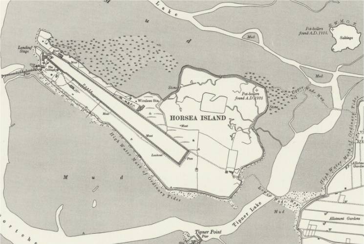
Horsea Island
Horsea was originally two islands, Great and Little Horsea. The islands were joined to form a torpedo testing lake in 1889, using chalk excavated from Portsdown Hill by convict labour. A narrow-gauge railway was constructed on the site by the army to distribute the chalk.
The island was connected, on the eastern side, to Portsea by two wadeways.
Map of Horsea Island.
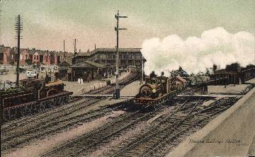
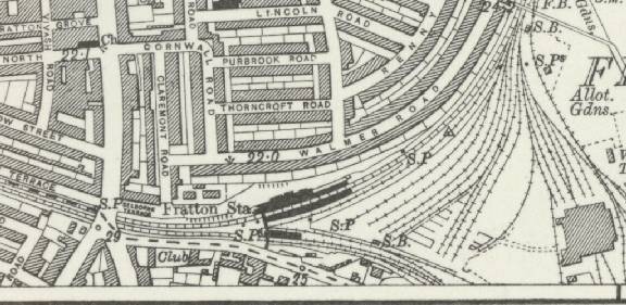
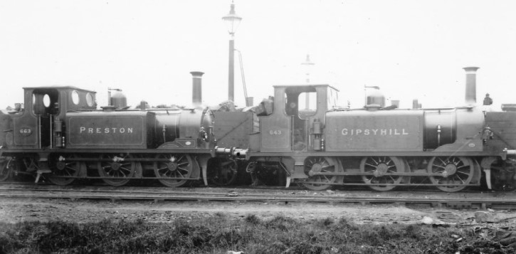
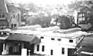
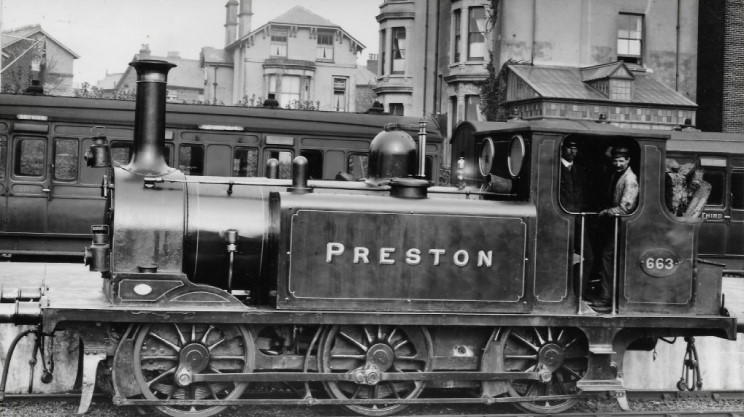
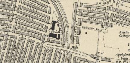
Fratton Station
Built in 1885 (some sources claim an unlikely date of 1847) with a branch line to East Southsea added in 1885. Renamed Fratton and Southsea in 1905 and back to Fratton again in 1921. Portmouth's engine sheds were moved to Fratton from the Town Station in 1891.
Fratton picture 1908 and map 1870's.
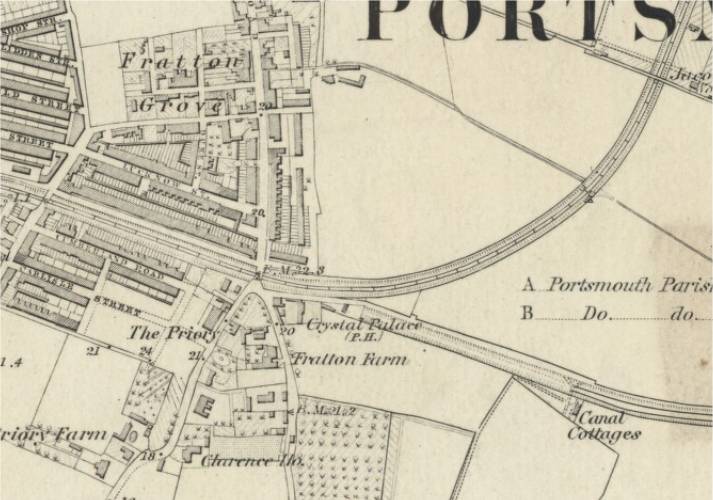
Map of Fratton showing engine sheds and East Southsea branch line (bottom centre).
Fratton Sheds 1963.
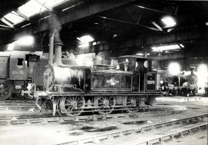
Fratton Sheds Early 1900s.
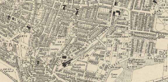
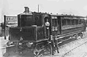
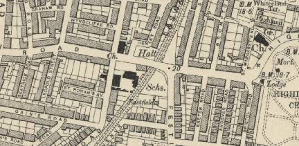
East Southsea Station
Built in 1885, by the Southsea Railway Company, running from Fratton to Granada road providing a connection to South Parade pier. After a year it was sold jointly to the L&BSCR and the L&SWR who agreed to operate the line on a alternate yearly cycle. In 1903 a newer, smaller, station was built when the line was used by railcars. After the introduction of railcars a couple of intermediate stations were opened in 1904. Jessie Road Bridge Halt and Albert Road Bridge Halt/Highland Road.
Last used in 1914 and closed as part of WW1 cuts on poorly used railways brought on in this case by Portsmouth developing a more competitive tramway system. During WW1 the line was used as an overflow siding for the Fratton goods yard and the East Southsea station became a munitions store.
The line was finally abandoned in 1923.
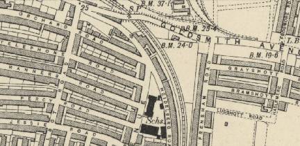
Map of East Southsea Station and the route through Southsea.
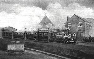
East Southsea Station as it originally looked and in 1966 before the final destruction.
An original steam engine in 1901, and a railcar used on the line in the later stages of its life.
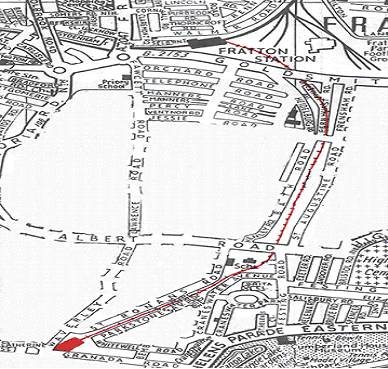
Maps of the bridge at Goldsmith Avenue and the halts at Jessie Road and Albert Road.
Photos of the halts.
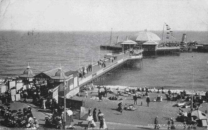
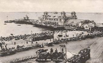
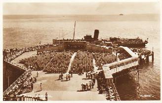
South Parade Pier
The East Southsea Station was built to bring the railway closer to South Parade Pier and onward access to the Isle of Wight. The first South Parade pier was opened in 1879 but the pier's pavilion was destroyed by fire on 19 July 1904. After the fire a second pier was reopened 12 August 1908, designed more for pleasure than a point of embarkation. In 1914 in an attempt to improve the financial prospects of Seaview Chain Pier the Seaview steam packet company was formed and began running a service between Seaview Chain Pier and South Parade Pier. The service came a halt in September 1914 and was formally prevented from further running by the Admiralty in 1915. There was another fire in 1974 which required part of the superstructure to be re-built.
Below are pictures of the original South Parade pier and the post-1908 pier with seating for an end-of-pier show.
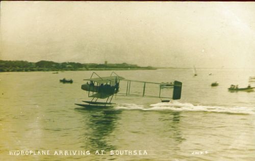
Hydroplane landing at Southsea beach from early 1900s
Copnor Station and Crossing
There was a plan for a station at Copnor, between Hilsea and Fratton, where the East Southsea branch would set out from. This was abandoned in favour of a station at Fratton. There remains a Station Road at Copnor where the station was to have been built.
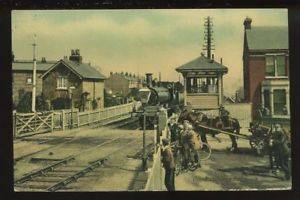
Originally there was a level crossing at Copnor which was replaced by a bridge in 1908. Pictured is the crossing in 1905.
Copnor crossing gate.
Level Crossings
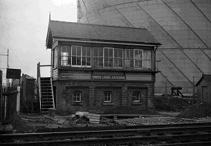
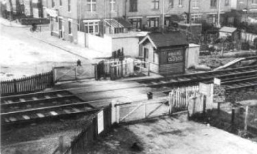
South of Hilsea Halt were The Green Lanes and Burrfields Road crossings.
Hilsea Halt
Opened 1937.
When the main line came to Portsmouth in 1858 there was a dispute over the Havant section. A temporary terminus (Havant New) was built north of Havant where passengers were transferred by horse-drawn omnibus to Hilsea, so bypassing the main Havant station. The passengers could then carry on into Portsmouth by train.
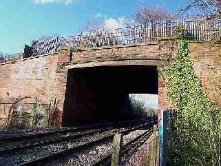
Hilsea Lines: The original defensive lines were constructed during 1756 and 1757 and subsequently demolished. The current lines were constructed between 1858 and 1871. They included special fortified bridges for road and rail access. Even before their completion the Hilsea Lines had been rendered obsolete due to advances in artillery technology.
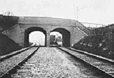
The tunnel through Hilsea Lines.
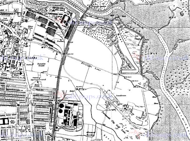
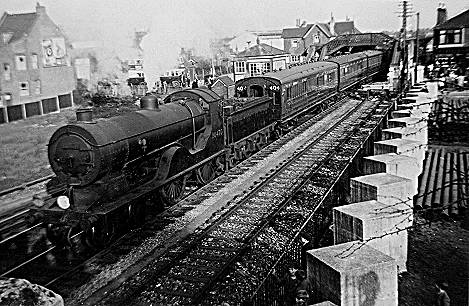
To the east of Hilsea Halt was the airport and to the west were the military sidings. Shown on the map below is Rat Lane which was later renamed as Norway Road after Neville Shute. Also pictured is the gated crossing in the 1950’s and the rickety bridge of the 1970’s.
Map of the 1930's.
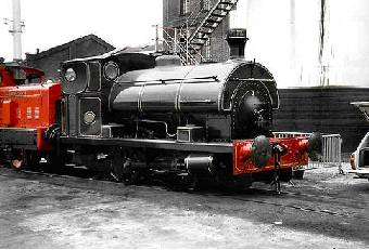
A restored Gasworks engine.
Portsmouth Airport: The Airport was opened in 1932 and closed in 1973.
Portsmouth's first plans for an airport were for a 3 part scheme of a seaplane base in Langstone, a municipal airport on Farlington Marshes and an international airport on Portsea Island. This idea dated from 1924 and was not proceeded with.
Portsmouth was always a grass airfield. First users were Portsmouth, Southsea and Isle of Wight Aviation Co (P.S.I.O.W.A.) with services to Ryde. Other airlines soon followed including International Airlines, Provincial Airlines and Jersey Airlines.
In September 1936 Portsmouth was the starting point for the Schlesinger African London-Johannesburg race for which there was only one finisher.
PSIOWA began to expand rapidly before the war and began to undertake aircraft maintenance and modification in their hangars at the airport in addition to the successful ferry services. At the start of the Second World War PSIOWA were ordered to stop their flying services in order to concentrate on the manufacture and repair side of the business. PSIOWA planes and pilots (including famous aviator Amy Johnson) were sent to serve as part of the National Air Communications Scheme while the site and skills at the Portsmouth Airport site were used to repair and modify several thousand military aircraft for return to service. The company changed its name to Portsmouth Aviation in 1946, with a view to expanding both the aviation and manufacturing sides of the business.
Airspeed Ltd moved to a new factory at Portsmouth Airport in 1933. Aeronautical engineer and novelist Nevil Shute Norway was employed by Airspeed, he has two roads in Portsmouth near to the airport site named in his honour. The company had been acquired by de Havilland Aircraft in 1940. In 1960 the firm moved all its remaining operations to their Christchurch factory.
After the war airline operation recommenced, but the writing was on the wall for Portsmouth Airport as aircraft became more demanding of runway length and surfaces. There were several accidents, mainly due to wet grass runways, culminating in two the same day on 15/8/67 when two Channel Airways HS.748s ran through the airfield boundary. Following these incidents operating restrictions were imposed which inevitably led to a downturn in aircraft and passenger totals.
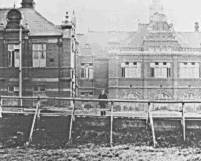
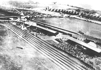
Airport Opening day July 2, 1932.

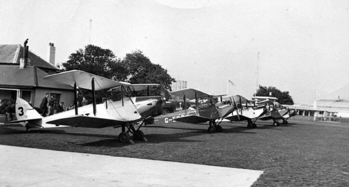
The Airport in the 1930s.
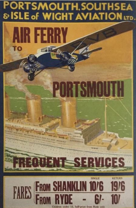
Airport Advert.
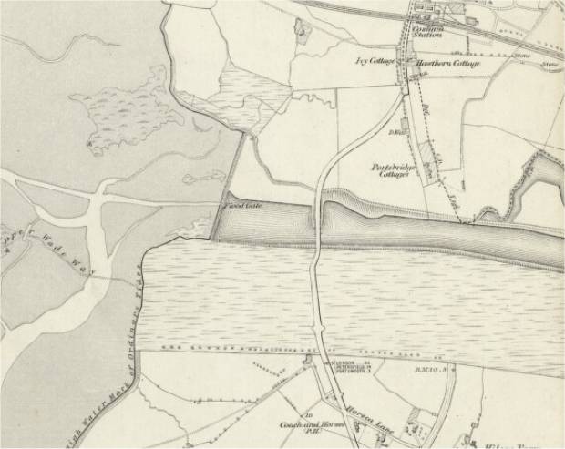
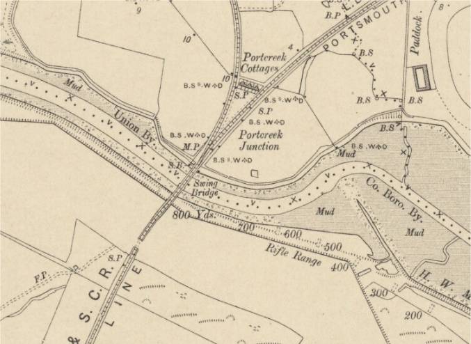
Ports Creek Bridge
Situated just north of Hilsea Halt and south of Portscreek Junction.
The LB&SCR built a wooden bridge across the creek in 1847. This was replaced by a swing bridge in 1870. An Admiralty order required the bridge to open between 2 and 3am on the first Sunday of every February. The swing bridge was supplanted by a drawbridge in 1909 which has been fixed in place since 1920.
Bridges have been built across the creek at various locations. The first record of a bridge dates from the 12th century. In the 15th-century a double-arched stone bridge was built. Prior to the new bridge in the 1800's the original road, and bridge, into Portsmouth was through the defences at that time with the route following 'Old Road' from Cosham and joining Portsea Island along what is now 'Peronne Road'.
1867 a new retractable bridge allowed the passage of gunboats, it was later fixed in place and reinforced to allow trams to run across. The bridge was replaced by a wider bridge in 1927, which in turn was replaced by the current structure in 1970 during the construction of the A27.
In 1941 the Eastern Road was extended over the creek to link Portsea Island at the eastern end.
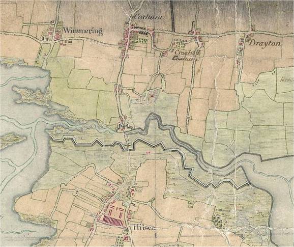
1700's map of road route into Portsmouth
The creek was deepened and made navigable by the Portsmouth & Arundel Navigation company in 1830 after the failure of the Portsea Canal. It proved difficult to keep the creek clear for navigation and a canal called the Cosham Canal was proposed to provide an alternative route, although it was never built. The canal company abandoned the creek in 1838.
An 1853 army report on the status of the Hilsea Lines mentioned that the creek was filled with weeds to the point where for 3 to 4 hours every day it could be walked across. Later in the decade as part of upgrade works on the Hilsea Lines, the creek was widened and deepened to allow it to be used by gunboats. Dams and flood gates were constructed at the ends of the creek to allow it to be kept in water at all stages of the tide. The remains of one of these dams can be seen at the eastern end of the creek.
The maps, below, show the new road and bridge together with the western floodgates, and the railway as a swing bridge plus the remains of the eastern floodgates.
Late 1800's map.
Early 1900's map.
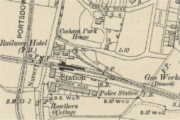
Cosham Station
In 1845 the London, Brighton & South Coast Railway obtained an agreement to build a line extending their Brighton to Chichester line to Portsmouth. Perceiving this as a threat to their traffic in the neighbourhood, the London & South Western Railway entered into negotiations with the Brighton company, as a result of which it was agreed that the South Western would build a connecting line from Fareham to a joint station at Cosham and that the line from Cosham to Portsmouth would be a joint LB&SCR/L&SWR line. Trains from Brighton to Portsmouth commenced on 14 June 1847. The Fareham to Cosham line opened on 1 September 1848, and L&SWR trains began running trains through to Portsmouth on 1 October 1848.
Cosham station in the early 1950s showing a line of anti-tank blocks which were part of the WWII invasion defences.
Cosham station and sidings early 1900's with Portsdown and Horndean Light Railway crossing over the track.
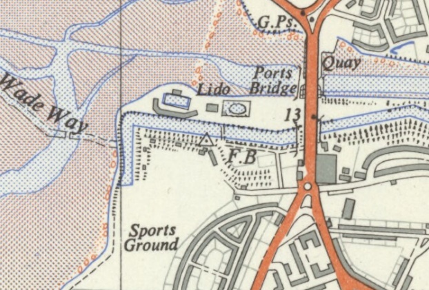
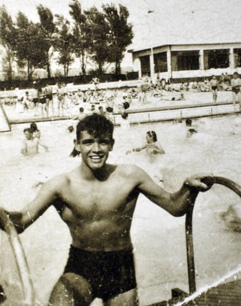
Hilsea Lido: Opened in 1935. The pool originally used seawater, converting later to freshwater.
During World War 2 the main pool was closed to the general public and was given over to the use of the various military units in the area. Between 1946 and 1951 a miniature railway ran along the lido site. In 1974 the Lido was used as a set for the Bernie’s Holiday Camp scene in the film Tommy. Later in the 70s the lido's diving platforms were removed. In 2006 plans for refurbishing the lido were abandoned but the lido reopened in 2014.
Hilsea Lido map 1950s.
Hilsea Lido in the 1950s and a visit from Sean Connery.

Portchester Station
Situated between Fareham and Cosham. Opened by the L&SWR in 1848.
Paulsgrove Halt
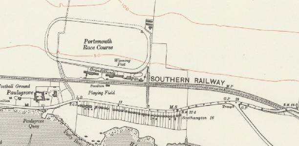
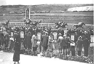
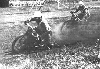
Situated between Cosham and Portchester evidenced by the Racecourse Lane bus stop on Southampton Road (near Tesco Superstore). The station was funded by local businessman George Cooper for the local racecourse. The station closed along with the racecourse when the land was acquired by the military in 1939 who used it as an ammunition dump. Opened in 1928 to serve the adjacent Paulsgrove Racecourse (usually referred to as Wymering or Portsmouth Racecourse). The course could accommodate 8,000 punters and had parking for 2,000 cars.
It was primarily used for pony racing and there was also a track for motor-cycle dirt track racing.
There has been on-going talk of re-building the station.
Map and photos of the track.
Farlington Halt
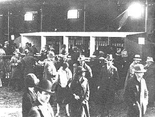
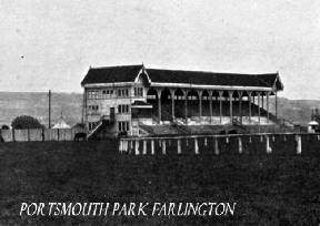
The station was situated on the triangle between Bedhampton and Hilsea. The existence of the station is evidenced by the road named Station Road running south from Havant Road. Built in 1891 as Farlington Racecourse and later Farlington Halt to initially serve the Portsmouth Park racetrack. The racecourse was closed in WW1 to be used as an ammunition dump and the station closed in 1917 to be opened again and closed again in the 1920’s for industrial use before being re-opened to the general public as Farlington Halt in 1928 but finally closed in 1937.
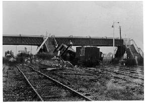
In 1894 there was a crash at the station.
Map and photos of the racetrack together with the crash site.

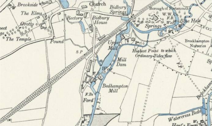
Bedhampton
Situated between Cosham/Hilsea and Havant. Opened in 1906 and originally named "Bedhampton Halt".
Bedhampton gates about 1910.
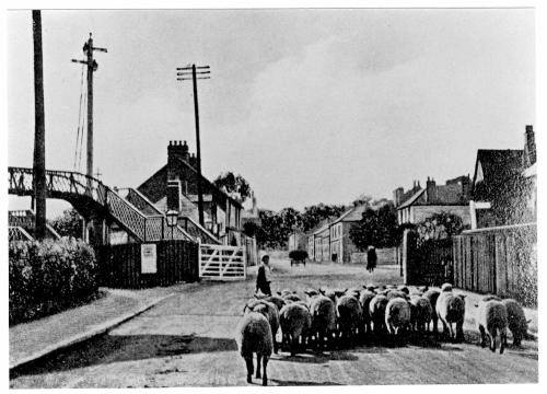
Bedhampton Mill sidings.
References:
Wikipedia - Portsmouth & Southsea Railway Station
Wikipedia - Portsmouth Direct Line
Wikipedia - London and South Western Railway
Wikipedia - London and Brighton Railway
Wikipedia - Portsmouth Harbour Railway Station
Wikipedia - Fratton Railway Station
Wikipedia - Paulsgrove Halt
Wikipedia - Farlington Halt
Wikipedia - Bedhampton Station
Wikipedia - Whale Island
Wikipedia - Portsmouth and Arundel Canal
Wikipedia - Portsmouth Airport
Wikipedia - Hilsea Lines
Wikipedia - Portsbridge Creek
Wikipedia - Isle of Wight Ferry Services
Wikipedia - Portsmouth Harbour
Wikipedia - Portsmouth Airport
Stuart Crow
Buriton Heritage Bank
May Brian
South Parade Pier
John Speller's Web Pages
Disused Stations
Portsmouth News
Past and Present Publications
David Heys Collection
History In Portsmouth
University of Portsmouth
Elm Tree Photos
Prints Place
Portsmouth Harbour and Spithead’s Nomination for World Heritage status
Subsim
Michael Cooper
Simplon Postcards
Hampshire Airfields
Southern Railway E-mail Group (SREmG)
SoPSE
Portsdown Tunnels
Old Maps Online