Click here for other railways.
Direct Line - Havant to LondonIn 1857 a direct, and much quicker, line from London to Portsmouth via Woking and Havant was completed by the Direct Railway Company and leased to L&SWR for services to Portsmouth with user rights over the existing section from Havant to Portsmouth. Until late 1859 LB&SCR and L&SWR were in disagreement over ownership of the line around Havant and the lines were blocked north of Havant (see section on Havant New Station). There was talk of building two separate lines from Havant to Hilsea and Cosham with a separate station at Portsmouth being needed for the second line.
For the first twenty years it was a single track although the tunnel and all the bridges and earthworks had been built for double tracks. In 1878 the line was ‘doubled’ and electrified in 1937.
Havant New Station
The direct route track lay idle due to a dispute between LB&SCR and L&SWR on running trains to Portsmouth over the existing lines around Havant. In 1858, the two local railway companies started the "Battle of Havant". The line was blocked and some suggest navvies from each side engaged in a pitched battle. Agreement was only reached late 1859. For a few weeks a temporary terminus (Havant New) between Havant and Rowlands Castle was erected by the L&SWR. Passengers would travel from Havant New station in a horse-drawn omnibus to Hilsea, bypassing the main Havant station. The passengers could then carry on into Portsmouth by train. After two years the companies came to an agreement and the L&SWR were allowed access to the disputed line.
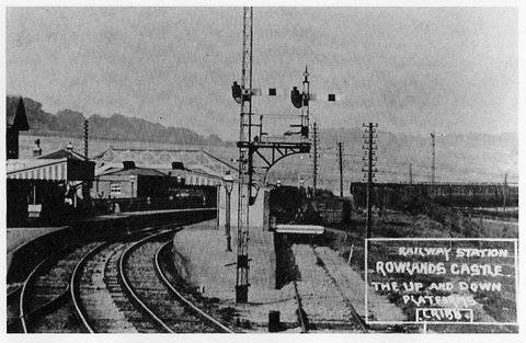
Rowlands Castle Station
Opened in 1859. The picture below shows the centre siding. The siding, thought to have been provided for the excursion trade, is large enough to provide for up to two coaches. There is some evidence also that horse boxes were left here and that horses destined for Goodwood Race Course were delivered to the station in the 1930’s.
The station in the early the 1900's.
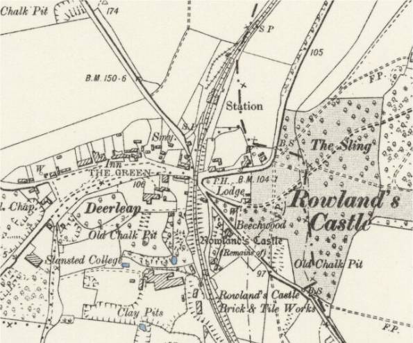
Map of the station and sidings early 1900's together with the Brick Works track to the south.
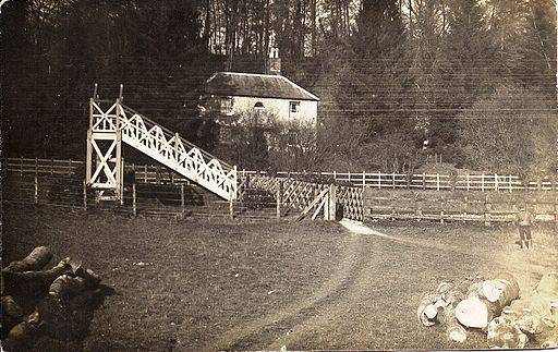
Woodcroft Halt/Ditcham Park Halt
Opened in 1943, closed 1945 and subsequently demolished. Today, only a footbridge remains.
During World War II, in 1940 the Admiralty requisitioned Ditcham Park, a nearby country house for use as a convalescent home for sailors. The halt was built to serve Ditcham Park, principally for trains from the extensive naval facilities in Portsmouth. The trains were sometimes rumoured to be loaded with 'ladies' from Portsmouth.
Because of its naval nature, it was featured on few maps, but some maps did mark it by a little tab without a name.
Likely site of Woodcroft Halt at the southern end of Harris Lane.
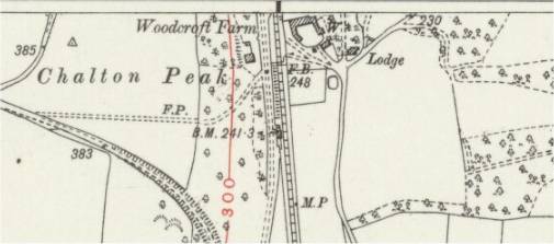
Possible early 1900's picture of the bridge at Woodcroft Farm.
Buriton Sidings and Limeworks
Buriton Sidings: For many years a goods train would come to the sidings every morning and you would get a note if there was something to be collected. You would then have two or three days to collect things; after that you were charged. There used to be a ‘coal club’ for manual workers living in the parish and most of the materials for the school used to come in by rail into the sidings. A communal trolley was available at the Five Bells to help carry things into the village, down Kiln Lane.
Buriton Lime Works: The limeworks were opened around 1860 (and closed in 1939). It was probably the building of the Portsmouth - London railway line which facilitated the introduction of the limeworks by making it possible to bring coal to Petersfield.
Three main chalk quarry pits (known as "France", "Germany" and the "White" pit) were developed over the years. Quite a complex internal network of 3 foot gauge railways and inclines was developed to carry the chalk around within the site. Trucks would be horse-drawn to the edge of an incline, controlled by a pony boy. From then on they would run down to the kilns by gravity. Those from the ‘White’ pit were run through the top of ‘Germany’ pit, across Kiln Lane into ‘France’ pit, under an incline, back across a second crossing over Kiln Lane and into the works where they would be tipped onto the loading floor of the kilns. A man would be stood on the back of the truck with his foot on the brake handle and another man would indicate when it was clear to cross Kiln Lane. With a crude foot-brake system (which pushed a wooden shoe up to rub against the wheels) being the only means of control that the man on the truck would have, and with speeds probably reaching 50-60 mph, spills were not uncommon. Wet rails were sanded to give grip but, even so, both experienced and inexperienced drivers would skid and the momentum would throw the truck forward, catapulting the driver and the load through the air. Empty trucks were returned to the pits (about three at a time) using horses until locomotives took over in 1923. There are recollections of two locomotives at the limeworks (40 horsepower ‘Simplex’ machines with Dorman petrol engines). At least one of these had been used in World War One for transporting supplies to the Allied front lines, and possibly for towing ambulance wagons.
A couple of trains per day would call at Buriton Sidings to take the lime away and to deliver the anthracite coke breeze. The mainline engine would push wagons into ‘the gully’ (the lower part of the limeworks) although the engine itself could not go into the gully.
The Lime Works are now a Nature Reserve.
Kilns and workers at the Lime Works.

Map mid 1900's - just north of the tunnel.

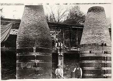
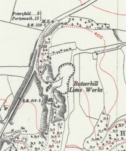
Butser Hill Lime Works: Little documentation available. Probably opened in 1930s and closed 1970s. Narrow guage railway on site.
Map mid 1900's.
Butser Hill Lime Works Photos.
28 Days Later
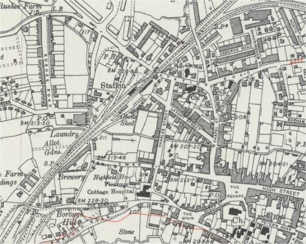
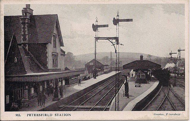
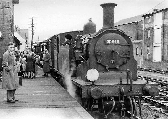
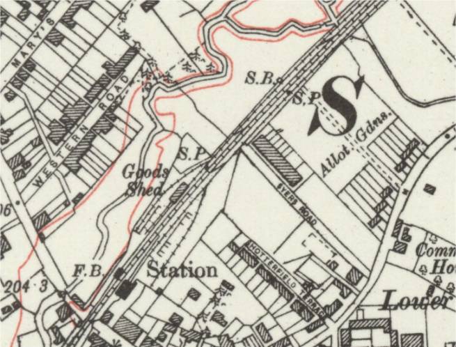
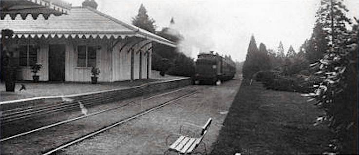
Petersfield Station
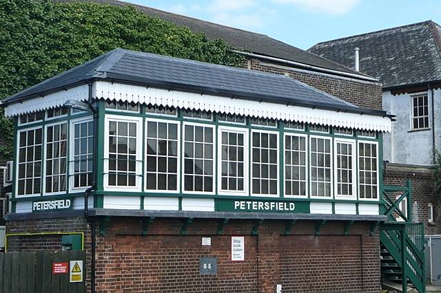
Opened 1859. The station was extended and enlarged in 1864 to accommodate the traffic from the new Petersfield Railway to Midhurst. The main buildings still date back to the opening of the line and are of a "town" type, larger than other wayside stations on the route but identical to Godalming. Petersfield Signal Box, a London & South Western Railway Type 3a signal box built c1885 is designated Grade II.
The map below shows the main station with sidings and goods shed. Private siding for Amey's Brewery? North of Station Road is the platform used for the Petersfield and Midhurst Branch (1860-1955).
Map mid 1900's.
Station 1930's.
Midhurst branch platform 1955.
Petersfield Signal Box.
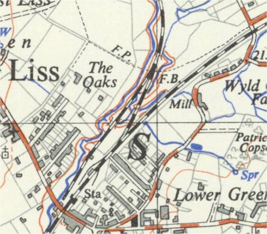
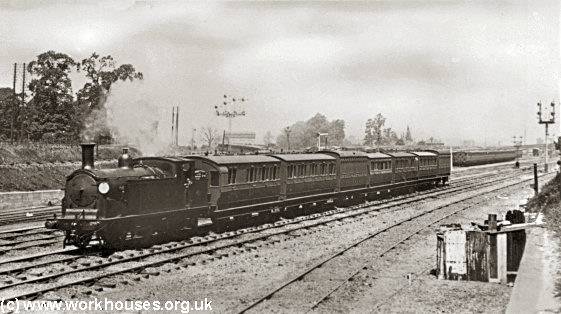
Liss Station
Opened 1859. It was one of two places where the Longmoor Military Railway joined the main line (the other being Bordon).
Liss Station map 1930's.
Liss Station map 1950's with the Longmoor connection branching off to the left.
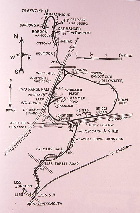
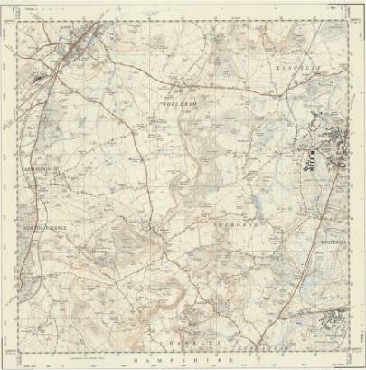
Longmoor Military Railway
The Longmoor Military Railway (LMR) was a British military railway built by the Royal Engineers from 1903 in order to train soldiers on railway construction and operations. Originally a tramway was laid to assist in removing 68 large corrugated iron huts from Longmoor Military Camp Camp to Bordon. The railway was relaid to standard gauge in 1905–1907 and was initially known as the Woolmer Instructional Military Railway. It was renamed the Longmoor Military Railway in 1935. The Liss extension was opened in 1933.
The stations and junctions included:
Bordon – the northern terminal, adjacent to Bordon station and with access to British Railways via the LSWR owned Bentley and Bordon Light Railway (now closed) which joined to London to Alton line at Bentley
Oakhanger Halt
Whitehill Junction
Two Range Halt
Woolmer
Longmoor Downs – the original terminus.
Weaversdown Halt
Liss Forest Road
Liss Junction
Liss – the southern terminus, with a platform adjacent to those serving the Portsmouth Direct Line.
An additional loop ran eastwards from Longmoor camp via a station at Hopkins Bridge to Whitehill Junction, completed in 1942. This provided circular running to the line, allowing for improved training without the need to turn trains at the terminals.
At its peak, the railway ran to over 70 miles (110 km) of operational laid track and sidings. The vehicles and stock on the LMR were very much an assortment to give the maximum learning opportunity. Well over a thousand locomotives had associations with the railway, although many only through the need for storage. The same was true of the signalling at the various locations on the line, including an Army version of flag signalling. After the end of World War II, the collection also included captured enemy equipment, including a "Schienenwolf" or railroad plough: a German wagon which dragged behind it a huge hook, used to destroy sleepers and so render railway lines unusable to advancing enemy troops. In addition to the various military items, there were old versions of standard passenger carriages.
A passenger service was operated over the line at various times, nominally for personnel required on the railway, and others from the War Department/Ministry of Defence and their families.
It was inevitable that the significance of the facilities offered by the LMR would be reduced in later years. Even so, the LMR was still important enough for the tracks of the Bentley to Bordon branch to be left in place when passenger services were withdrawn on 16 September 1957. This line remained in place as, although there was a British Railways connection at Liss, the Bordon branch made it easier to accommodate the movements of military traffic at short notice. In 1966, the movement of goods over the Bordon branch was suspended, and the line was taken up in 1967.
In the light of the reducing role of the military and the severely reduced British Empire, it was decided by the Ministry of Defence to close the railway. On hearing of its impending closure local locomotive preservation groups became interested in acquiring the small but complete rail system, and a bid was placed to purchase LMR along with the airstrip at Gypsy Hollow which would have enabled the production of a unique transport museum. The MOD rejected this proposal, which had been backed by the Association of Railway Preservation Societies and The Transport Trust. However the Army did offer the last 1½ miles of line from Liss Forest Road to Liss. The offer was accepted, a provisional lease was drawn up and planning permission was sought for developments at Liss. Unfortunately the people of Liss did not share this enthusiasm and opposed the planning permission.
The railway was used as the location for a number of films including The Lady Vanishes (1938), Bhowani Junction (1956), The Inn of the Sixth Happiness (1958), The Great St Trinian's Train Robbery (1966), and Chitty Chitty Bang Bang (1968). In 1956 the railway was used to stage a train derailment for the BBC programme Saturday Night Out when Ex-SR King Arthur class locomotive 30740 Merlin and three coaches were pushed down an incline onto a specially canted section of track.
Longmoor Camp Rail Network.
Longmoor Camp Rail map - from north of Liss to Bordon.
Longmoor Camp Rolling Stock.
Mike Morant Collection
Videos of Longmoor.
Youtube Videos
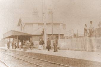
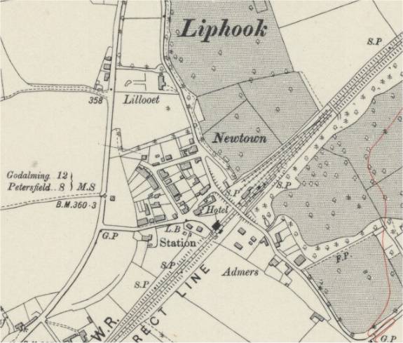
Liphook Station
Opened 1859.
Liphook Station 1865.
Liphook Station and Goods Yard map 1940's.
Haslemere Station
Opened 1859. Until 1938, when the line was electrified and an additional platform added Haslemere was just a standard wayside station.
Haslemere Station 1930s map.
Haslemere Station 1940s map with added line and platform.

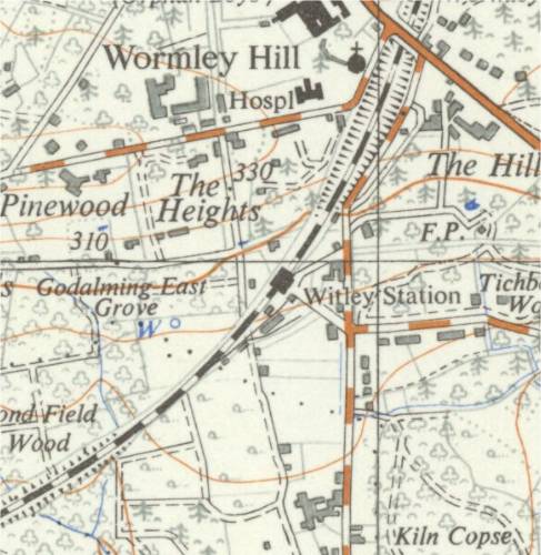
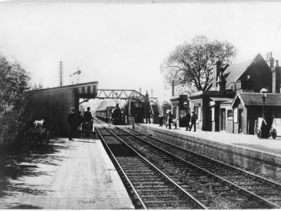
Witley Station
Opened 1859 as Witley and Chiddingfold. Renamed Witley 1947.
Witley Station 1940s map.
Witley Station (probably 1960s).

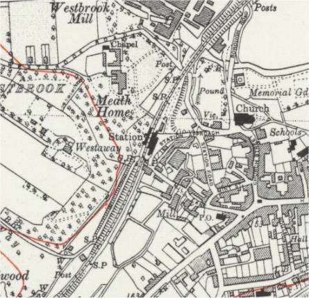
Opened 1859.
Milford Station 1940s map.

Milford Station 1908.
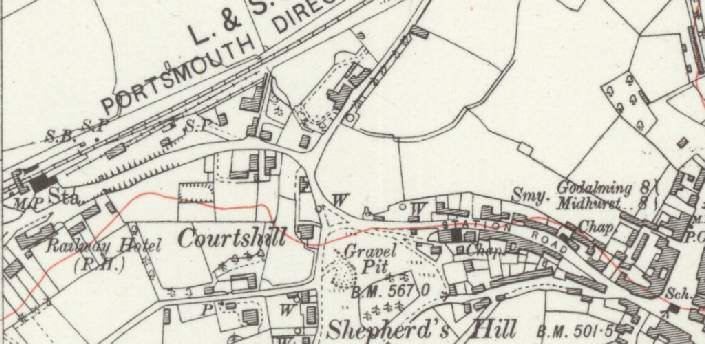
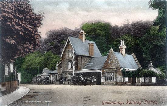
Godalming Station
Opened at current location in 1859, built in a mock Tudor style and is a Grade 2 listed building. The original single platform terminus station, opened in 1849, was located on a spur from just south of Farncombe station, north of the River Wey. It was closed to passengers in 1897 but was retained as a goods yard until 1969. In 2006 Godalming station was renamed "Shere" for three days while filming took place for the movie "The Holiday".
Godalming Station 1940s map.
Godalming Station 1905.
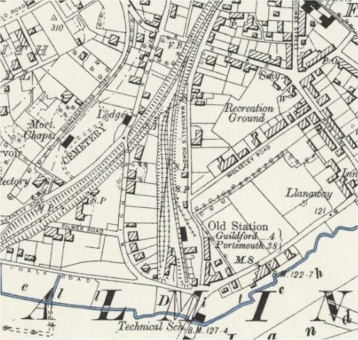
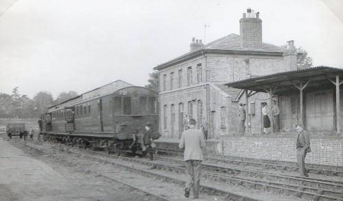
Opened in 1849, was located on a spur from just south of Farncombe station, north of the River Wey. It was closed to passengers in 1897 but was retained as a goods yard until 1969. The site is now a residential development, the road being called appropriately Old Station Way.
Godalming Old Station late 1800s map.
Godalming Old Station 1957.
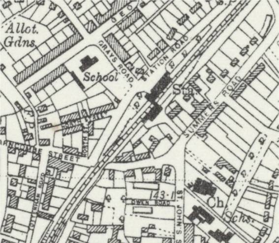
Farncombe Station
Opened in 1897. It is said to have been built at the instigation of General Sir Frederick Marshall, a director of the London and South Western Railway Company, who lived nearby at Broadwater.
Farncombe Station 1940s map.
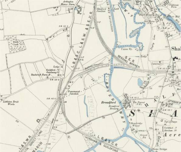
Peasmarsh and Shalford Junctions
The top branch goes to Redhill and the bottom one is the Cranleigh Line of the London Brighton and South Coast Railway to Horsham, which opened in 1865 and closed in 1965. The line to Horsham was once seen to be the route to the South Coast (Shoreham) before the Portsmouth Direct line had ben completed, but that never came to anything.
The abandoned railway shown in the map was built to link Redhill to Portsmouth before the Direct Portsmouth Railway was completed and was never used and no track was ever laid. It was built in the 1840s and abandonned in 1859.
Map late 1800s.
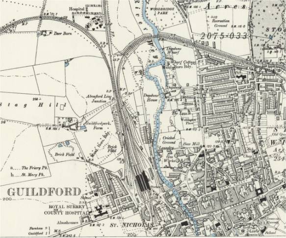
Guildford Station
Opened by the London and South Western Railway (LSWR) in 1845 to connect to Woking, but was substantially enlarged and rebuilt in 1880.
The Reading, Guildford and Reigate Railway (Reading , Guildford and Redhill) opened in 1849, and was operated by the South Eastern Railway.
LSWR services to Farnham via Tongham began in 1849 and the New Guildford Line to Leatherhead and Epsom Downs in 1885. On the latter line is the other Guildford station: London Road: the line to it describes a curve around the town on an embankment, crossing the River Wey by a high bridge.
Guildford station was also the northern terminus of the (now-closed) Cranleigh Line of the London Brighton and South Coast Railway, which opened in 1865 and closed in 1965. This line ran to Horsham by way of Cranleigh, Rudgwick and Christ's Hospital.
Guildford station was the site of an important motive power depot opened by the LSWR in 1845. The original building was demolished in 1887 to make room for the enlargement of the station, and was replaced by a semi-roundhouse which was substantially enlarged in 1897. This was closed and demolished in 1967.
For a history of Guildford and photos visit David Hey's Collection Page 32. See also Pages 33 and 34.
1912 Railway Clearing House map of lines around Guildford.
Guildford Station and Engine Sheds maps late 1800s.
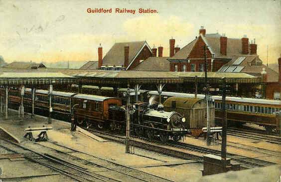
Guildford Station 1908.
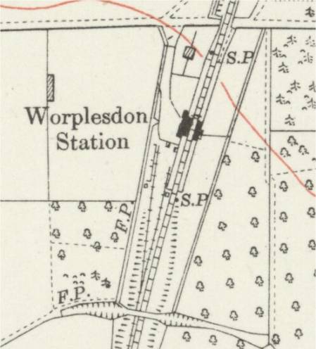
Worplesdon Station
Opened in 1883 surrounded by open heath and farmland.
Worplesdon Station 1920s map.
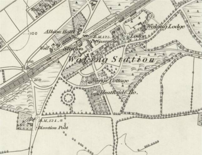
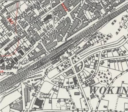
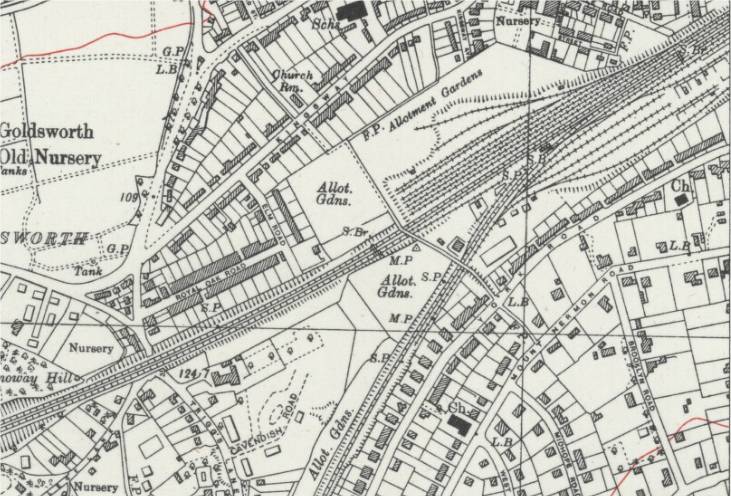
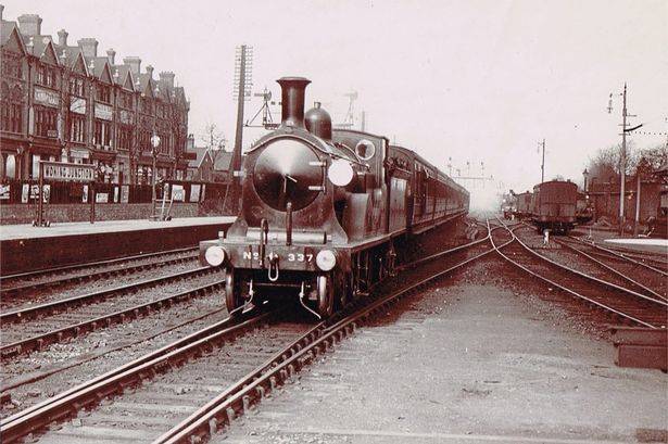
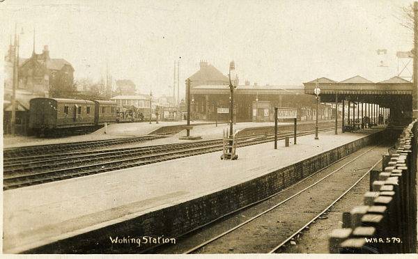
Woking Station
Opened as Woking Common in 1838 as a terminus, by the London and Southampton Railway (L&SR) which connected London to Southampton, and renamed as Woking in 1843 by what was then the L&SR renamed as the London and South Western Railway (LSWR).
Woking became a junction with the opening of the Guildford Junction Railway (GJR) in 1845.
During the 1830's and 40's there was little incentive to build upon the heath land closer to London, owing to the costs involved in enclosing undeveloped land. It was the development of another part of the heath - by the London Necropolis and National Mausoleum Company in the 1850's - that really brought about the 'new' town of Woking. The remaining heath land was sold for development from 1855 onwards.
For photos of Woking visit David Hey's Collection Page 35.
Woking Common Station map mid 1800s.
Woking Station map late 1800s.
Woking Station map 1940s.
Woking Junction map late 1800s.
Woking Junction map late 1940s.
Woking Station around 1900.
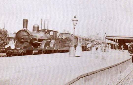
Woking Station (Junction?) around 1900.
Woking Station 1930s.
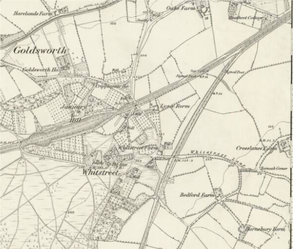
Brookwood Cemetery
Brookwood Cemetery, also known as the London Necropolis, was opened 1854 and was at one time the largest cemetery in the world. Today, it is the largest cemetery in the United Kingdom and one of the largest in Europe. The cemetery is listed a Grade I site in the Register of Historic Parks and Gardens.
During the 1840's, churchyards in the capital were becoming full, resulting in the Burials Act of 1850 which prevented further burials in London and allowed cemeteries to be built away from the city. It was suggested that sparsely populated areas with good transport links to the capital should be used for these cemeteries. In 1854, 400 acres of the land bought by the 'London Necropolis' company, at Brookwood in the west of Woking Borough, were used for a national cemetery.
Brookwood originally was accessible by rail from a special station – the London Necropolis railway station – next to Waterloo station in Central London. Trains, with passenger carriages reserved for different classes and others for coffins (also for different classes), ready for safe carriage by horse-drawn vehicles ran into the cemetery on a dedicated branch from the adjoining South Western Main Line – a junction was just to the west of Brookwood station. The original London Necropolis station was relocated in 1902 but its successor was demolished after suffering bomb damage during World War II.
Two stations were in the cemetery itself: North for non-conformists and South for Anglicans. Their platforms still exist along the path called Railway Avenue. For visitors wishing to use the South Western Main Line, Brookwood station has provided direct access since June 1864. A commemorative very short piece of track with signpost and plaque which purposefully gives way to a grass field recollects the old final main stage of the journey of the deceased.
Brookwood Cemetery map late 1800s.

Brookwood funeral train 1902.
Brookwood North section (Dissenters') Station early 1900s.
Brookwood South section Station currently.

Video of Brookwood/Waterloo.
Youtube Videos
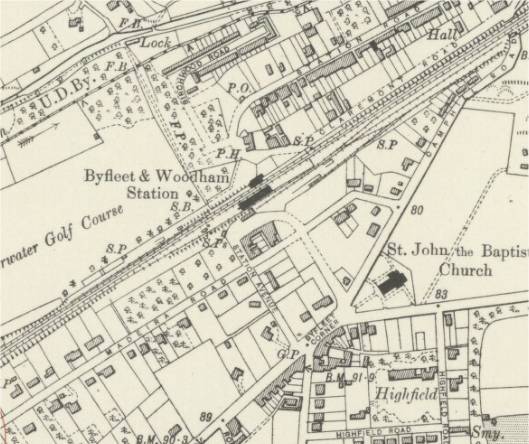
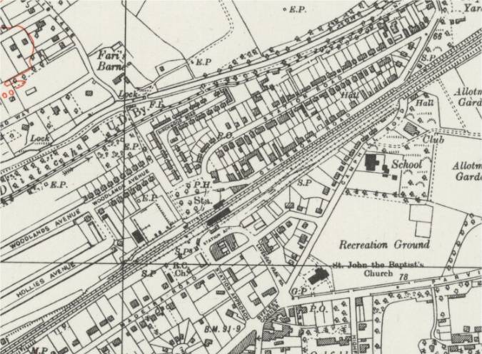
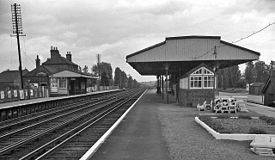
West Byfleet Station
Opened in 1887 as Byfleet and Woodham, and renamed as West Byfleet.
Byfleet and Woodham 1920s.
West Byfleet 1940s.
West Byfleet Station 1962.
Byfleet and New Haw
Opened in 1927 as "West Weybridge" and changed to its present name in 1962.
Byfleet and New Haw 1940s.

Weybridge Station
Opened in 1838.
Weybridge Station, Brooklands, Weybridge Junction and the Byfleet Curve in 1920s.

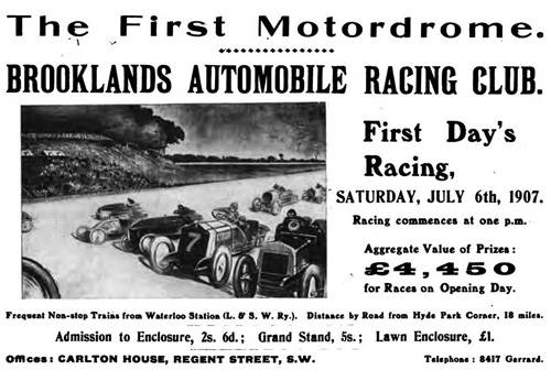
Brooklands: was a motor racing circuit and aerodrome. It opened in 1907 and was the world's first purpose-built motor racing circuit as well as one of Britain's first airfields, which also became Britain's largest aircraft manufacturing centre by 1918. The last race was in 1939 and today part of it forms the Brooklands Museum. Watch Youtube Videos of Brooklands car racing.
Brooklands advert for the first day.
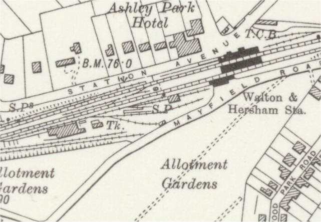
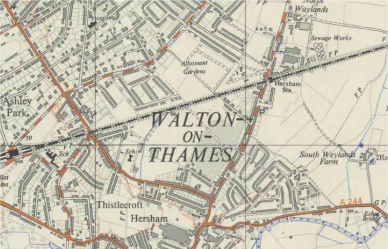
Walton-on-Thames Station
Opened in 1838 as Walton and Hersham Station.
Walton-on-Thames Station 1930s.
Hersham Station
Opened in 1936.
Hersham Station map 1950s.
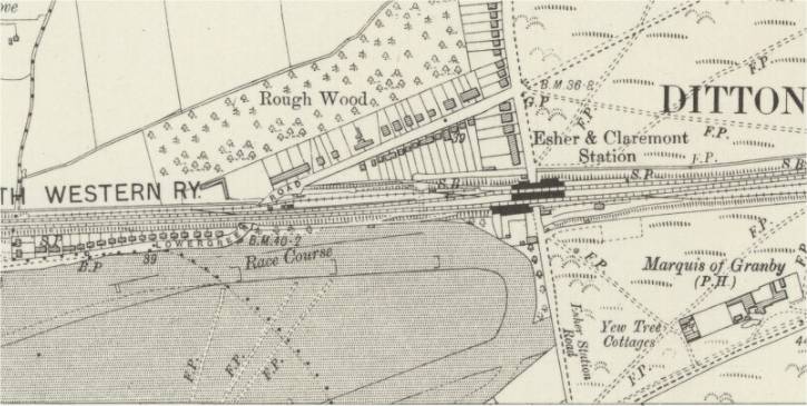
Esher Station
Opened in 1838 as "Ditton Marsh", renamed "Esher and Hampton Court" around 1840, and again as " Esher and Claremont" in 1844, and finally "Esher" in 1913. The station gives access to Sandown Park Racecourse.
Sandown Park Racecourse: was one of the first courses to charge all for attending. It opened in 1875 and everyone had to pay at least half a crown.
Esher Station map early 1900s showing edge of racecourse.
Esher Station 1940's when it was signed as "Esher for Sandown Park".
Esher Station 1960's.
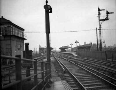
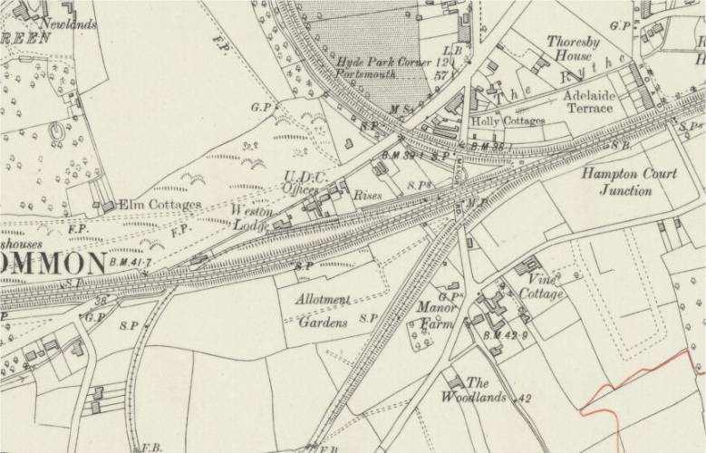
Hampton Court Junction map early 1900s showing Hampton Court Branch (built in 1849) to the north and the Guildford Line (opened in 1885) to the south.
Surbiton Station
The London and Southampton Railway intended its line to go via Kingston but Kingston Corporation objected, fearing a deleterious impact on their coaching trade, and the railway passed about 1.5 mi (2.4 km) south of the town with the first "Kingston" station opening in 1838 on the east side of King Charles Road. In 1840 it was resited 0.5 miles west to Surbiton, then little more than a farm.
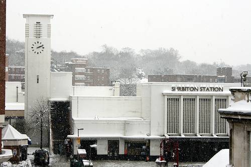
Successive renamings of the station were "Kingston Junction" in 1852, "Surbiton and Kingston" in 1863 when the present Kingston railway station opened on the branch line, and "Surbiton" in 1867. The station was completely rebuilt in 1937 designed by J Robb Scott in an art deco style.
The station had a moderately sized goods yard which was situated on the eastern side of the station platforms. Two additional sidings were located on the western 'up' side of the station and were served by a short loading platform. In addition to local goods facilities, the main yard was also used as the loading point for the short lived Surbiton - Okehampton car carrier service that ran between 1960 and 1964. The main goods yard finally closed in 1971.
Surbiton and Kingston Station map late 1800s.
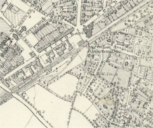
Surbiton Station map early 1900s.
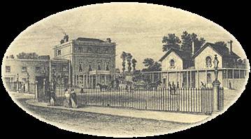
Surbiton Station 1850.
Surbiton Station Art Deco.
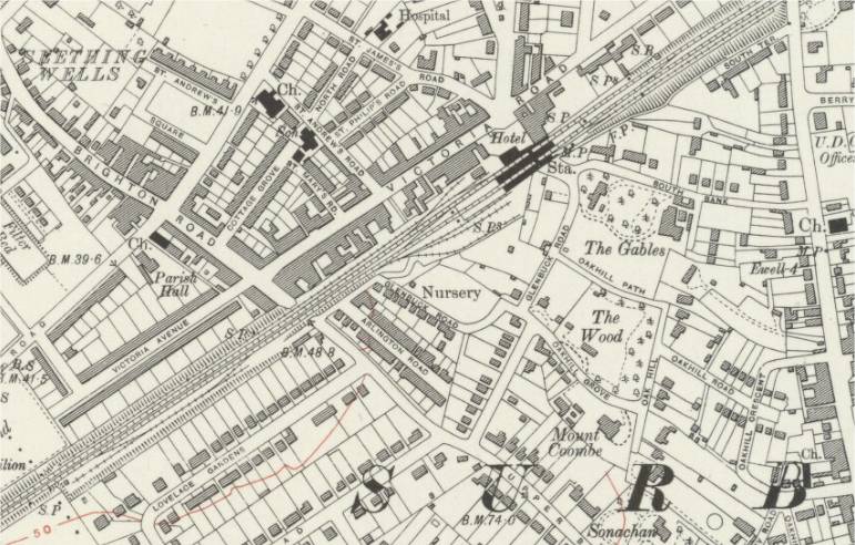
Berrylands Station
Opened in 1933. Berrylands is one of the few stations around the London area still constructed with wooden platforms.
Berrylands map 1930s.
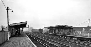
Berrylands Station 1960s.
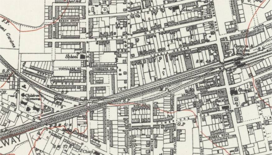
New Malden Station
Opened in 1846 as "Malden", renamed "New Malden and Coombe" in 1859, and "Coombe and Malden" in 1862, and "Malden for Coombe" in1912, and "Malden" in 1955, and finally "New Malden" in 1957.
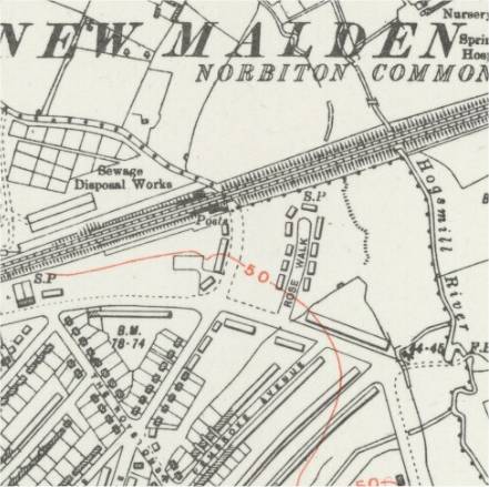
New Malden map 1930s showing Kingston Branch line.
New Malden early 1900s.
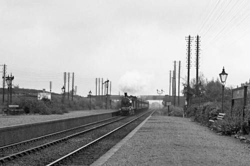
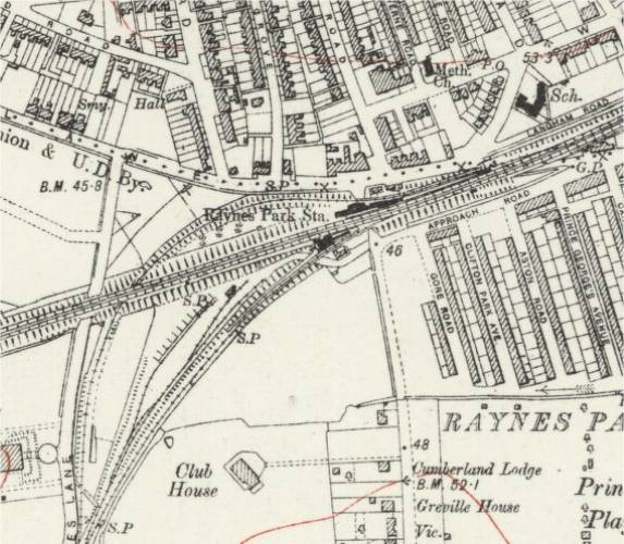
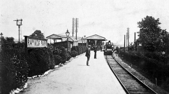
Raynes Park Station
Opened in 1871.
Raynes Park map 1920s showing Wimbledon and Epsom Branch line.
Raynes Park Station early 1900s.
Wimbledon Station
Originally opened in 1838 situated to the south of the current station on the opposite side of the Wimbledon Bridge.
In 1855, the Wimbledon and Croydon Railway (W&CR) opened the West Croydon to Wimbledon Line. In 1868 the Tooting, Merton and Wimbledon Railway (TM&WR) opened a line to Tooting Junction.
In 1889 the station was rebuilt on its current site for the opening of the District Railway (DR, now London Underground's District line). In the late 1920s the station was rebuilt again with its current Portland stone entrance building.
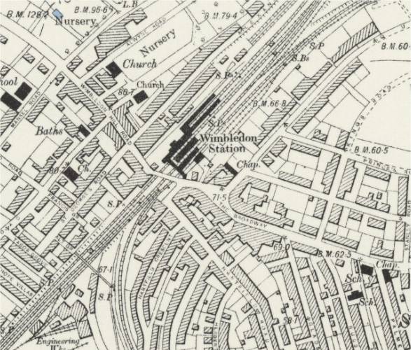
Wimbledon map late 1800s showing Engineering Works and Branch lines.
Wimbledon Bridge 1875.
Wimbledon Station.

Wimbledon Station early 1900s.
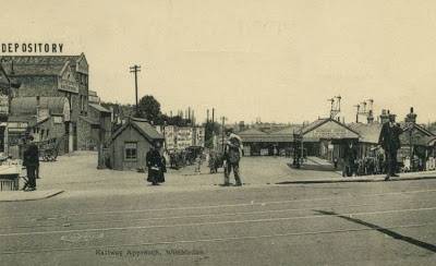
Wimbledon Station early 1900s.
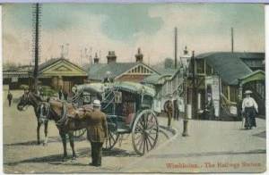
Wimbledon Station early 1900s.
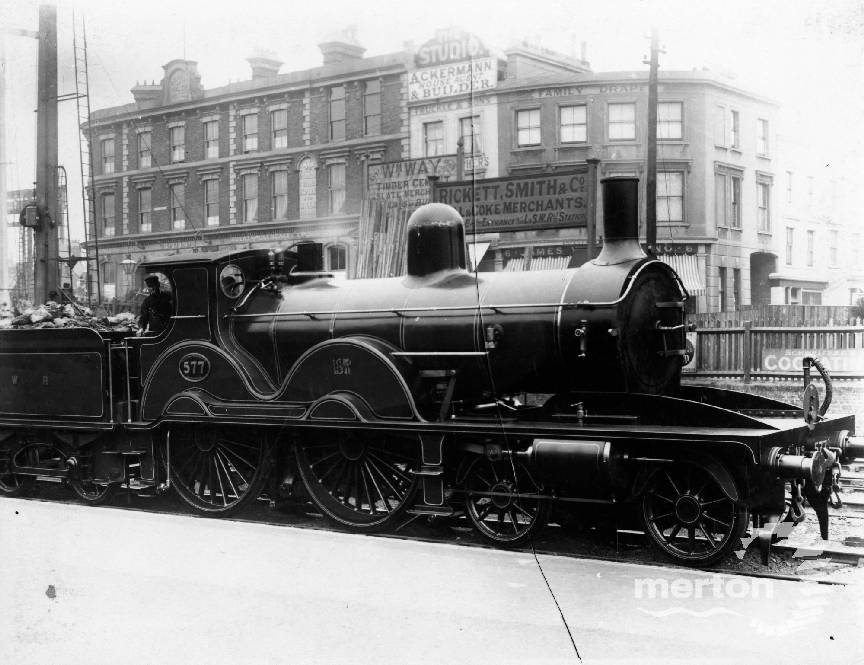
Wimbledon steam engine early 1900s.
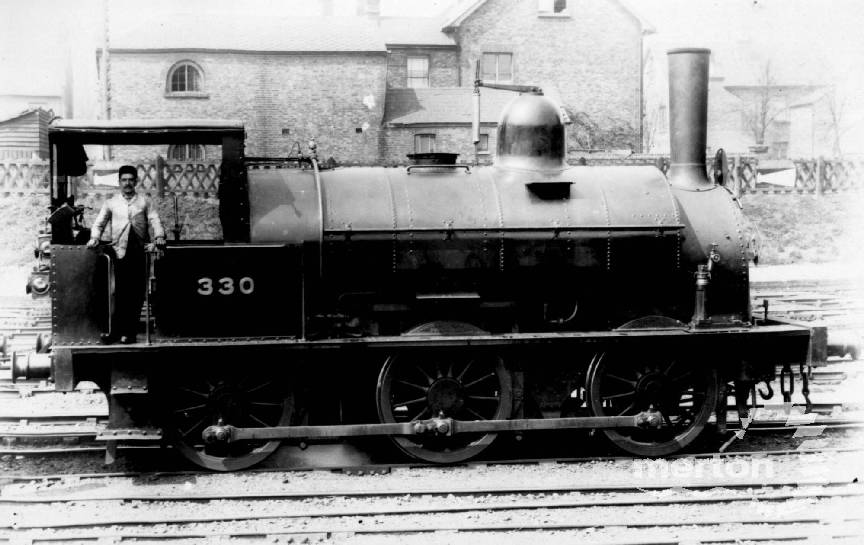
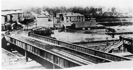
Wimbledon West Yard looking south in 1927.
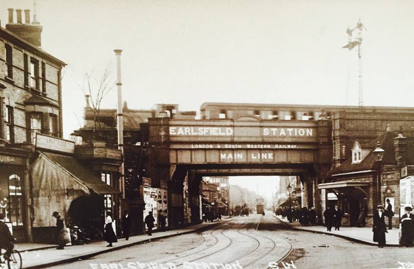
Earlsfield Station
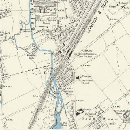
Opened in 1884. Shown on maps as "Earlsfield and Summers Town".
Earlsfield Station map late 1800s.
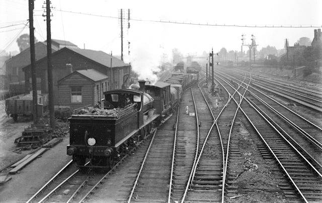
Earlsfield Station early 1900s.

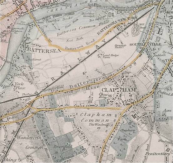
Wandsworth Station
Opened in 1838 and closed around 1858. Renamed "Clapham Common" in 1846. Built by the London and Southampton Railway as their first station out of London (Nine Elms), it was built on the side of what is now Battersea Rise as the line had curved to avoid the high ground at Clapham Common.
New Wandsworth Station was opened in 1858 by the West End of London and Crystal Palace Railway. It was on the south side of Battersea Rise opposite Clapham Common Station and closed in 1869.
Wandsworth map 1840s showing realtion to Nine Elms.
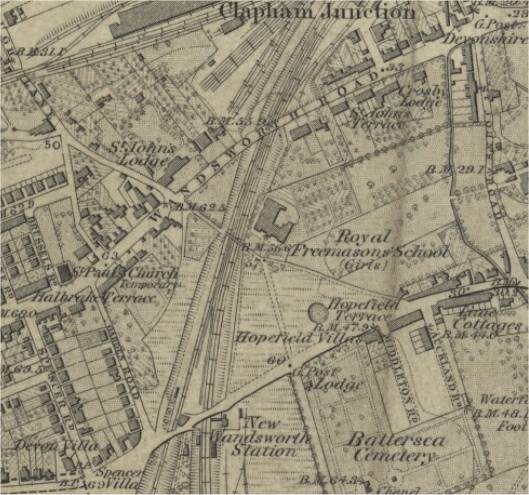
New Wandsworth station map 1870s - station no longer on the London and South Western Line.
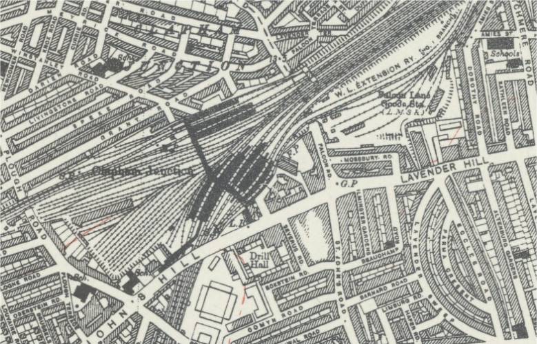
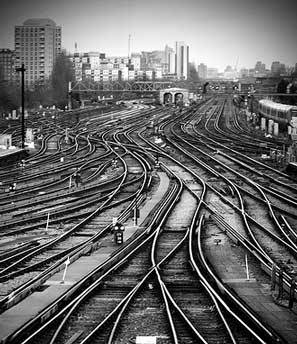
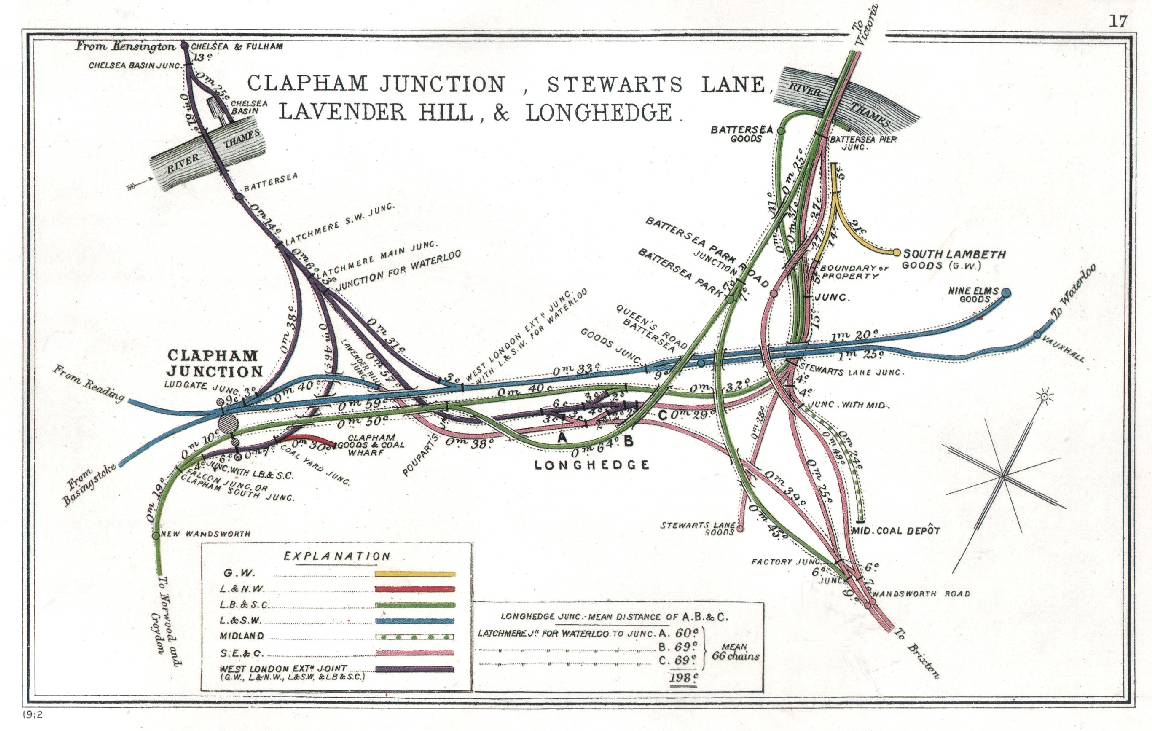
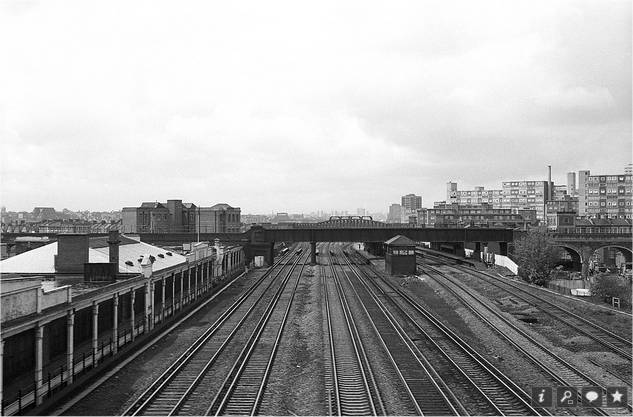
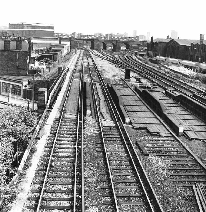
Clapham Junction Station
Clapham Junction (in spite of being in Battersea) opened in 1863, a joint venture of the L&SWR, the London, Brighton and South Coast Railway (LB&SCR) and the West London Extension Railway (WLER) as an interchange station for their lines. Additional station buildings were erected in 1874 and 1876. Each company had its own platforms and booking office.
The line to Waterloo was opened in 1848 and the line to Victoria in 1860.
Clapham Junction Station map 1940s.
Early view of Clapham Junction Station looking north from Wandsworth Road bridge. The double track of the LSWR main line is seen on the left with three LBSCR tracks in the centre with the dual gauge tracks of the West London Extension Railway on the right.

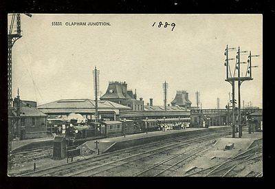
Early view of Clapham Junction Station looking to the north.

Clapham Junction station 1889.
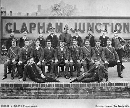
Clapham Junction Station staff early 1900s.
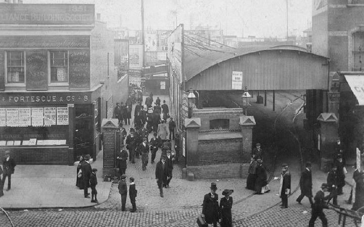
Clapham Junction Station entrance on St John’s Hill 1906.
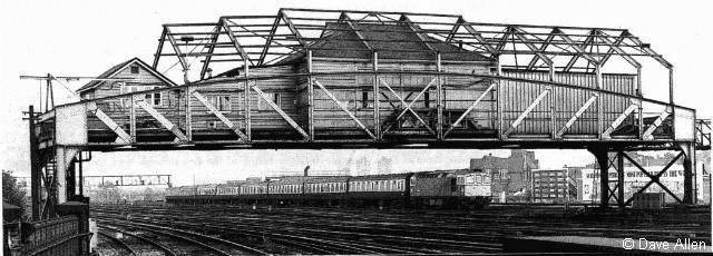
Clapham Junction A signal box built 1907.
Clapham Junction today.
Clapham Junction route map 1912.
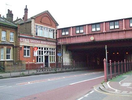
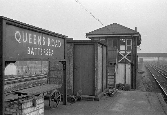
Queenstown Road Station
Opened in 1877 as "Queen's Road (Battersea)", and renamed "Queenstown Road (Battersea)" in 1980. By common use it is now called "Queenstown Road".
Queenstown Road Station map late 1800s.
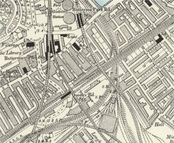
Queenstown Road Station showing original name of Queen's Road.
Queenstown Road Station 1980s.
Queenstown Road Station platforms.


Longhedge Junction bridge over Queenstown Road Station showing evidence of GWR broad gauge line to Victoria.
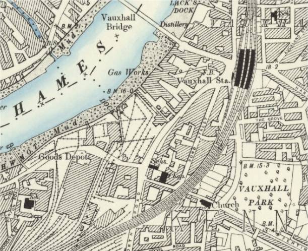
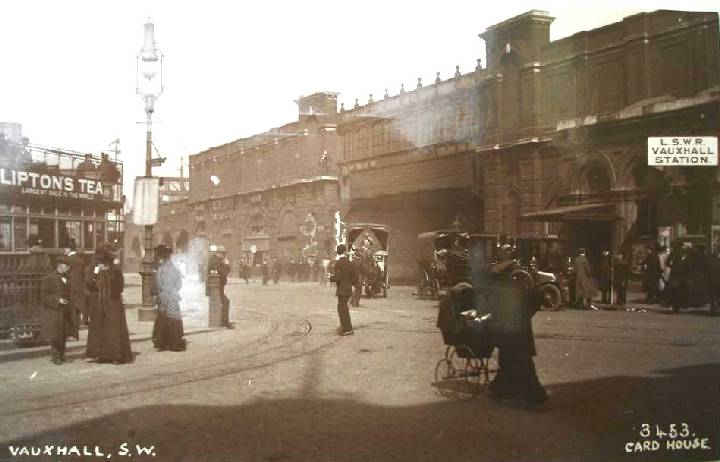
Vauxhall Station
Opened as "Vauxhall Bridge Station" in 1848 when the main line was extended from Nine Elms to Waterloo.
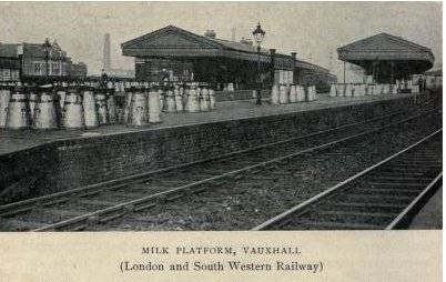
Milk trains: Vauxhall was located next to a major creamery and milk bottling plant for United Dairies. The regular daily milk train was from Torrington, but milk trains from all over the West Country would stop at Clapham Junction in the evening, and reduce their length by half so that they did not block Vauxhall station while unloading. They would then proceed to Vauxhall, and pull into the "down" side platform, where a discharge pipe was provided to the creamery on the other side of the road. There was also pedestrian access from below the station, under the road to the depot, in the tunnel where the pipeline ran. Unloaded trains would then proceed to Waterloo, where they would reverse and return to Clapham Junction to pick up the other half of the train. The procedure was then repeated, so that the entire milk train was unloaded between the end of evening peak traffic and the start of the following morning.
Vauxhall Station map late 1800s after the building of Vauxhall Park (1890) and the destruction and development of Vauxhall Gardens (1859).
Vauxhall Station early 1900s.
Vauxhall Station milk platform.

Vauxhall 1850s.
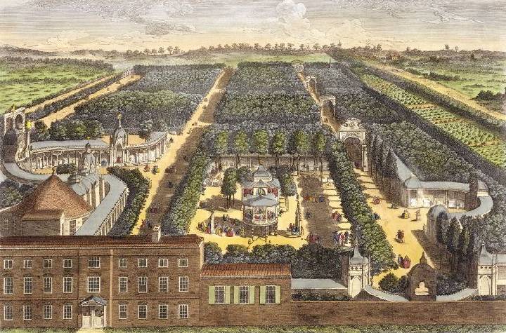
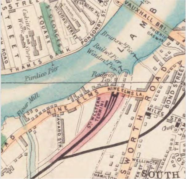
Vauxhall Gardens 1850s (detail). Showing Vauxhall Gardens, entrance to Old Vauxhall Bridge and Nine Elms Station.
Vauxhall Gardens: Vauxhall Gardens (or Vaux Hall Gardens) was re-launched in 1732 as the first and most significant of the true Pleasure Gardens of Georgian London. It was first opened for public use soon after 1660, as a rural tavern and place of assignation called the New Spring Garden. One of the great enduring attractions of Vauxhall Gardens was the artificial illumination, activated after sunset. Before the lights were lit, Vauxhall was a respectable wooded park where families with children could safely enjoy a rural promenade; after dark, the walks, now inhabited by courting couples, sexual predators and pickpockets, became more threatening, despite the presence of London's first professional police force.
The gardens closed in 1859, after almost two centuries as a hugely successful business. During that time, it underwent many changes in its architecture, its attractions and its audience, but its life can meaningfully be broken down into just three main periods of about seventy years each – the first (or 'New Spring Garden' period) from 1661 until 1728, the second ('Tyers Years'), from 1729 until 1792 when it was owned and managed by two generations of one family, and the third from 1793 until 1859 (the 'Capitalistic Mass Entertainment'), when it was transformed from the elegant and fashionable rendezvous it had become into a more populist commercial venue for balloon flights, fireworks, circus performers, massed bands and other spectacular entertainments.
The 'New Spring Garden' 1661-1728: Diarists John Evelyn and Samuel Pepys were regular visitors enjoying the perennial delights of a visit, in particular the boat-trip across the Thames, the song of the resident nightingales, and the seductive women who made Vauxhall one of their favoured places of work. The New Spring Garden entered the literature and drama of the period as an archetypal setting for romance, intrigue and adventure.
Scattered among the trees were numerous roofed wooden arbours with pub-like names as well as old coach bodies adapted as makeshift arbours for visitors who wanted to be private; disused boats were hung from the branches as a retreat for men who wished to smoke. Smoking was later banned as antisocial, and pet dogs were excluded for a similar reason. Informal entertainments were available in the form of strolling musicians, buskers, and acrobats. Alcoholic beverages, cold meats, and tobacco or snuff were all available to buy at exorbitant cost and questionable quality in the tavern. It is likely that admission was free at that time.
The Tyers Years, 1729-1792: In 1729, 'Vauxhall Spring-Gardens', as it was known, was sub-let to Jonathan Tyers (1702-1767). He was also keen that his pleasure garden should be capable of imparting a moral message to his visitors, he determined to clear out the prostitutes and the immoral behaviour and to replace them with an 'innocent and elegant' entertainment where respectable Londoners of all classes, with their families, could enjoy a civilised, enjoyable and even educational evening out; this was something that was not otherwise available to ordinary Londoners.
Early eighteenth-century London was a noisy, dangerous, smelly and violent place; it was also riven with hypocrisy, corruption and wickedness of all sorts. In taking on and sanitising the New Spring Gardens, Tyers intended to provide an escape from this, but also an example that the rest of London could follow. His pleasure garden would kick-start the civilisation of Georgian London, turning it into a worthy capital city for the newly-united Great Britain. He would exclude nobody from his gardens simply because of their class or status, but anybody who did choose to visit would gain, while there, a subliminal polite education, and would leave a better person.
The egalitarian and 'polite' nature of Tyers's vision, both entirely novel concepts to London, would be the cornerstones of his new pleasure garden for the rest of the century, and an underlying key to their longevity. To start with, however, they almost derailed the project in its first year. For the 1732 re-launch party, which he called a Ridotto al Fresco, Tyers created a centrepiece display of five tableaux showing the evil consequences of self-indulgence and intemperance. Unsurprisingly his self-indulgent and pleasure-seeking audience were not best pleased. Had Tyers not subsequently sought the advice of his friend the artist William Hogarth, his new venture could have sunk without trace. Hogarth was himself about to launch his series of 'modern moral' paintings and engravings, having realised that a moral message is best received when it is disguised with humour and enjoyment. Tyers's master-stroke was to convert his on-site house's ball-room into a raised pavilion with a private dining room and an open loggia for the use of Frederick Louis, Prince of Wales, Vauxhall's ground-landlord. Prince Frederick was the most popular member of the royal family, and his youthful energy gave him broad appeal. Wherever Frederick went, fashionable society was sure to follow.
With the change of use of the Gardens formal music events were staged including those by the composer George Frideric Handel. Tyers instituted an admission charge of one shilling which remained unchanged for almost sixty years however it was always raised for special events, sometimes to double or triple the normal rate. Whether by accident or by design, Tyers's Vauxhall became a feast for all the senses. The sweet country air, the excellent music, and the smartly-dressed visitors made a refreshing contrast to London's noisome streets, and daily problems and worries could be easily forgotten. The delicious sensory experience of being enveloped in a dream-world of perfumed flowers, charming music, fine design and beautiful works of art, especially at night, as well as eating and drinking good fare, and literally rubbing shoulders with elegant society, was a vivid, unforgettable and addictive experience which encouraged visitors to return again and again.
After his death in 1767, Jonathan Tyers's pleasure garden was passed to his second son, also called Jonathan (1728/9-1792). Despite the apparently seamless continuity, the 25 years of the younger Jonathan's management are marked by a singular lack of innovation or entrepreneurship, and only a handful of noteworthy events. Although he maintained what his father had created, he added very little to it, and was consequently responsible for a drop in the quality both of the entertainments and of the 'company' themselves.
Capitalistic Mass Entertainment 1792 - 1859: When Bryant Barrett (1743-1809) took over the management following the death of Jonathan Tyers the younger (his father-in-law) in 1792, he had to dream up new ways of attracting visitors. Income receipts would have continued to dwindle had it not been for the introduction of the one activity guaranteed to exert a powerful draw on even the most jaded Londoner – ballooning. Without the income generated by spectators and participants in balloon flights, it is likely that Vauxhall Gardens would have closed considerably earlier than it did. The first regular Vauxhall flights took place in 1802.
Bryant Barrett's two sons, Revd Jonathan Tyers Barrett (1784-1851) and George Rogers Barrett (1787-1860) (great-grandsons of Jonathan Tyers the elder), took on the ownership of the gardens on the death of their father in 1809. It is not known who was responsible for Vauxhall's radical change of direction in 1816, but it was that year that saw the first appearance at the Gardens of the sensational French tight-rope walker and rope-dancer, Madame Saqui. Her spectacular performances became a regular and hugely popular part of Vauxhall's entertainments for the next four years; after which other acrobats and tightrope walkers took over and developed Saqui's role. Madame Saqui's tight-rope act opened the doors to a plethora of circus acts.
In the 1820s, Jonathan Tyers's family finally gave up Vauxhall Gardens altogether. In 1821 they leased the Gardens to a business partnership made up of Thomas Bish, Frederick Gye and Richard Hughes. The partners approached King George IV to request a license to use 'Royal' in the title of the Gardens, and the king agreed.
Thomas Bish resigned from the management partnership in 1825, leaving Frederick Gye and Richard Hughes to manage Vauxhall on their own. In this, they were remarkably successful for a while, seeing record attendances in several seasons, and huge profits. However, they appear to have over-invested recklessly both in the Gardens and in their other businesses, and in 1840 they were declared bankrupt. This left the property in the hands of trustees for the next eighteen years, during which several lessees came and went, with varying degrees of success. It was increasingly hard to reverse the inevitable desertion of customers, attracted away in ever larger numbers by the newer and more sophisticated entertainments offered by music-halls and seaside piers. It was also becoming ever harder to attract effective managers, and to resist the tide of development of an expanding London, which was itself inflating property values exponentially, finally making Vauxhall more profitable as building land than as a visitor attraction.
After several false alarms, Vauxhall Gardens did finally close for ever after the evening of 25 July 1859. Anticipating its end, the developers had already moved in and acquired the site earlier that month turning it into prime freehold building land capable of accommodating three hundred new houses.
Vauxhall Gardens today: All trace of Vauxhall Gardens itself, whether above or below ground, was obliterated during the demolition of 1859, and the subsequent re-development of the land.
In the 1970s, the houses that had covered the site of the gardens for a century, cheaply built, badly war-damaged, and suffering from long neglect, were demolished in the slum-clearances. The Government was encouraging the creation of inner-city parks, so the dozen acres that had been Vauxhall Gardens were once more cleared and grassed over by the new owner, the London Borough of Lambeth, in an act of enlightened altruism. The resulting park, first opened to the public on 9 October 1976, was originally called Spring Garden, but in 2012, after a campaign by the Friends of Vauxhall Spring Gardens, was re-named Vauxhall Pleasure Gardens.
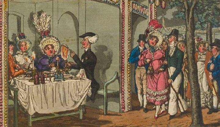
Images of Vauxhall Gardens.
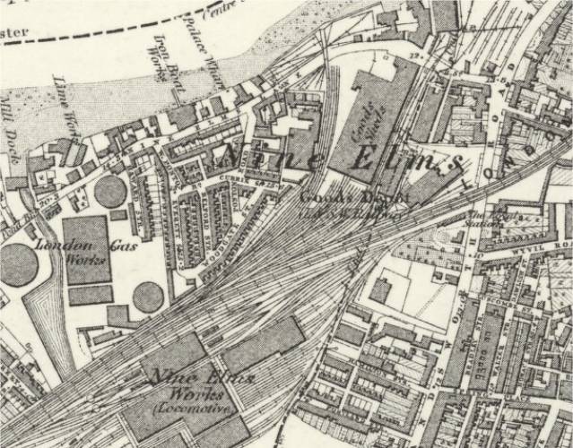
Nine Elms
Nine Elms Railway Station was opened in 1838 as the London terminus of the London & Southampton Railway which on the same day became the London and South Western Railway. The building in the neo-classical style was designed by Sir William Tite. The station was inconveniently situated for travel to central London, with the necessity to complete the journey by road or by steam boat.
A scond line from Nine Elms was opened in 1846, this went initially to Richmond and was later extended to Windsor.
The station was closed to passengers from 11 July 1848 when the L&SWR opened its metropolitan extension from Nine Elms to Waterloo (then called Waterloo Bridge Station), and the area adjacent to the station housed the L&SWR's carriage and wagon works until their relocation to Eastleigh in 1909. In 1941 the building was damaged by German bombs and it was demolished in the 1960s. The site became the flower section of the New Covent Garden Market in 1974.
Nine Elms 1830.
Nine Elms Station 1838.
Nine Elms Station map mid 1800s with new line to Waterloo on right.
Nine Elms map 1840s showing the Richmond Line.
Nine Elms work sheds 1896.

Nine Elms complex early 1900s.
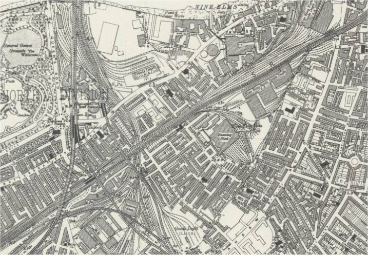
Nine Elms complex mid 1900s.
Nine Elms Shed 1902.
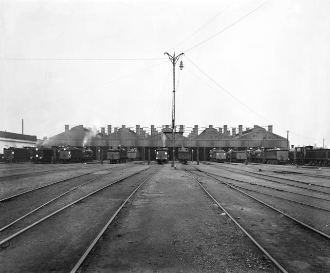
Nine Elms Shed 1902.
![]()
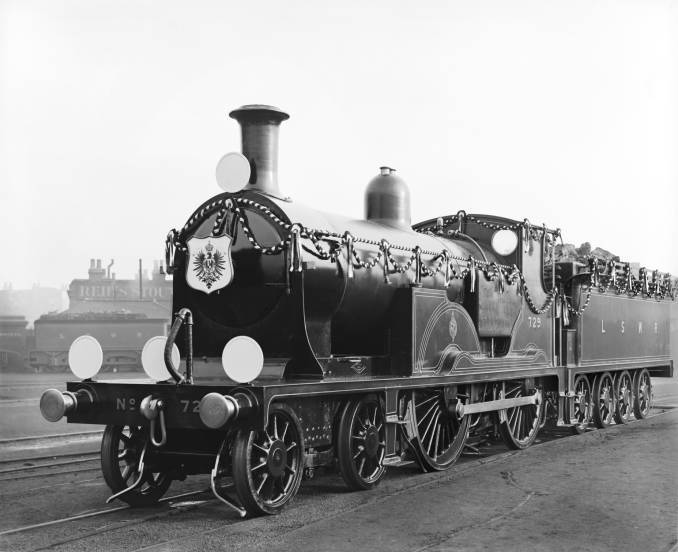
Decorated Engine Nine Elms 1907.
Nine Elms sheds 1916.

Videos of Nine Elms.
Youtube Videos
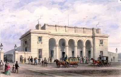
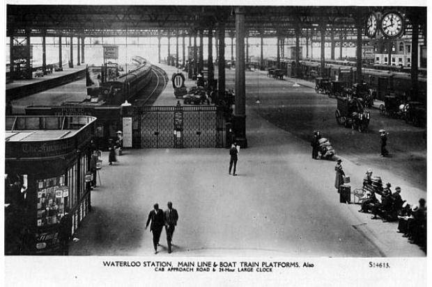
Waterloo Station
The London and South Western Railway (L&SWR) opened the station in 1848 as "Waterloo Bridge Station" (changed in 1886 to "Waterloo Station") when its main line was extended from Nine Elms, the original London terminus.
The L&SWR's aim throughout much of the 19th century was to extend its main line eastward beyond Waterloo into the City of London. Given this, it was reluctant to construct a dedicated grand terminus at Waterloo. However traffic and passenger usage continued to grow and the company expanded the station at regular intervals, with additions being made in 1854, 1860, 1869, 1875, 1878 and 1885. In each case the long-term plan was that the expansion was 'temporary' until Waterloo became a through-station, and therefore these additions were simply added alongside and around the existing structure rather than as part of an overall architectural plan.
This resulted in the station becoming increasingly ramshackle. The original 1848 station became known as the 'Central Station' as other platforms were added. The new platform sets were known by nicknames – the two platforms added for suburban services in 1878 were the 'Cyprus Station', whilst the six built in 1885 for use by trains on the Windsor line became the 'Khartoum Station'. Each of these stations-within-a-station had its own booking office, taxi stand and public entrances from the street, as well as often poorly marked and confusing access to the rest of the station.
By 1899 Waterloo had 16 platform roads but only 10 platform numbers due to platforms in different sections of the station or on different levels sometimes duplicating the number of a platform elsewhere. A little-used railway line even crossed the main concourse on the level and passed through an archway in the station building to connect to the South Eastern Railway's smaller station, now Waterloo East, whose tracks lie almost perpendicular to those of Waterloo. Passengers were, not surprisingly, confused by the layout and by the two adjacent stations called 'Waterloo'.
In 1898, the company opened the Waterloo & City line, a 'tube' underground railway that ran directly between Waterloo and the City.
A total rebuild started in 1904 and was completed in 1922.
The station was the London terminus for Eurostar international trains from 1994 until 2007, when they were transferred to St Pancras International.
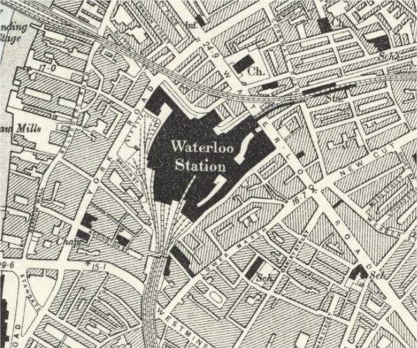
Waterloo Station map late 1800s with line across to Waterloo East.
Waterloo Station 1848.
Waterloo Station layout 1888 showing line across Waterloo Road.
_p141_-_Waterloo_Station_(plan).jpg)
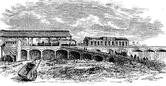
Track across Waterloo Station.
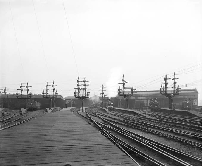
Waterloo Signals 1892.

Waterloo Station 1900.
Waterloo Station early 1900s.
Waterloo Station 1910.
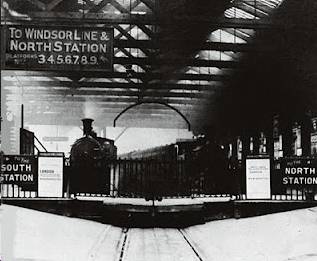
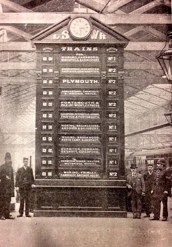
Waterloo Station Indicator Board 1898.
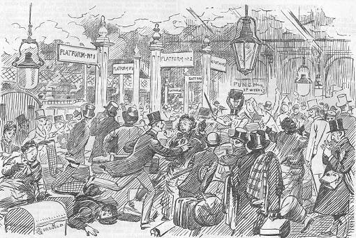
Waterloo Station Punch cartoon 1883 (BATTLE OF WATERLOO STATION. Puzzle - TO FIND THE TRAIN YOU WANT, OR ANYONE ABLE TO GIVE YOU ANY INFORMATION).
Waterloo Goods Depot 1902.
Boat Train leaving Waterloo for Southampton 1902.
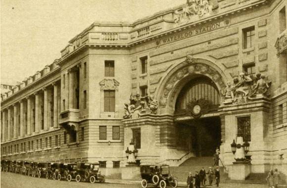
Waterloo Station modern frontage.
Videos of Waterloo Station.
Youtube Videos
Waterloo Necropolis Company Station
In the wake of public concerns following the cholera epidemics of the 1840s new burials were prohibited in what were then the built-up areas of London. Two large new cemeteries just outside the boundaries of the Metropolitan Burial District were planned while the promoters of the Necropolis scheme planned a single large cemetery far enough from the city so as never to be affected by urban growth, to be reached by railway.
A single very large tract of land was bought in Brookwood near Woking to be called Brookwood Cemetery or the London Necropolis. At this distance, the land would be far beyond the maximum anticipated size of the city's growth, greatly reducing any potential hazards. In 1854 the new cemetery opened and the first scheduled London Necropolis Railway train left the new London Necropolis railway station for the cemetery.
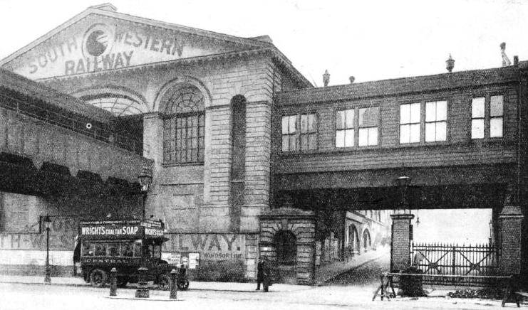
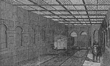
The first Necropolis Company Station at 121 Westminster Bridge Road, opened in 1854 and closed in 1902 due to the pressing need of more space at Waterloo Station. It was adjacent to the new Waterloo station and built by architect William Tite and engineer William Cubitt. The LNC had contemplated, but decided against, taking over the LSWR's former terminus at Nine Elms railway station. The ground floor contained a grand entrance hall and staircase for mourners attending first class funerals, a smaller entrance hall and staircase was for those attending lower classes of funeral.
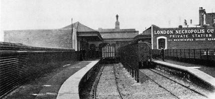
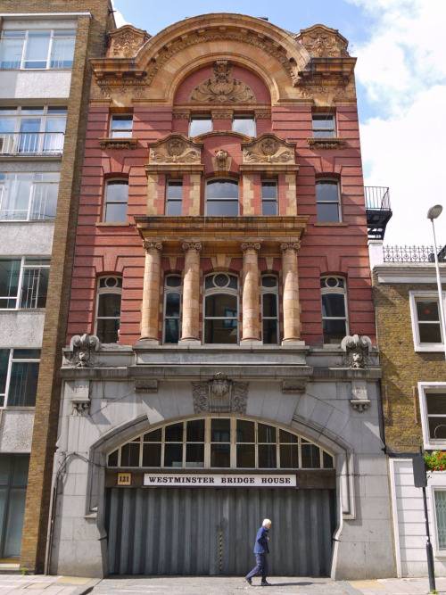
The second Necropolis Company Station, opened in 1902 and closed in 1941 having been bombed in WW2, was situated south of the existing station and on the opposite side of Westminster Bridge Road, its main entrance was at 188 Westminster Bridge Road. After the war it was deemed not economically worth operating a special service to Brookwood.
Entrance to First Necropolis Station 1890's.

Platform of First Necropolis Station.
Platform of Second Necropolis Station.
Entrance to Second Necropolis Station building today.
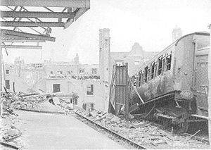
Second Necropolis Station bomb damage.
Video of Brookwood/Waterloo.
Youtube Videos
References:
Wikipedia - Portsmouth Direct Line
Wikipedia - Rowlands Castle Railway Station
Wikipedia - Petersfield Railway Station
Wikipedia - Woodcroft Halt
Wikipedia - Liss Railway Station
Wikipedia - Longmoor _Military Railway
Wikipedia - Liphook Railway Station
Wikipedia - Haslemere Railway Station
Wikipedia - Witley Railway Station
Wikipedia - Milford Railway Station
Wikipedia - Godalming Railway Station
Wikipedia - Farncombe Railway Station
Wikipedia - Guildford Railway Station
Wikipedia - Worplesdon Railway Station
Wikipedia - Woking Railway Station
Wikipedia - Brookwood Cemetery
Wikipedia - Nine Elms Railway Station
Wikipedia - Waterloo Railway Station
Wikipedia - London Necropolis Railway Station
Wikipedia - West Byfleet Railway Station
Wikipedia - Byfleet and New Haw Railway Station
Wikipedia - Weybridge Railway Station
Wikipedia - Brooklands
Wikipedia - Walton-on-Thames Railway Station
Wikipedia - Hersham Railway Station
Wikipedia - Esher Railway Station
Wikipedia - Surbiton Railway Station
Wikipedia - New Malden Railway Station
Wikipedia - Berrylands Railway Station
Wikipedia - Raynes Park Railway Station
Wikipedia - Wimbledon Railway Station
Wikipedia - Earlsfield Railway Station
Wikipedia - Clapham Junction Railway Station
Wikipedia - Queenstown Road Railway Station
Wikipedia - Vauxhall Railway Station
Wikipedia - Vauxhall Railway Station
Wikipedia - Vauxhall Gardens
The Vauxhall Society
Vauxhall Gardens
Rowlands Castle Historical Society
Buriton Heritage Bank
Brookwood Cemetery Society
Historic England
John Speller's Web Pages
Disused Stations
David Heys Collection
Southern E-Mail Group
The Andrews Pages
Six Bells Junction
National Railway Museum
David Turner Railway History
SVS Film
The Industrial Railway Society
Black Cab London
Old Maps Online